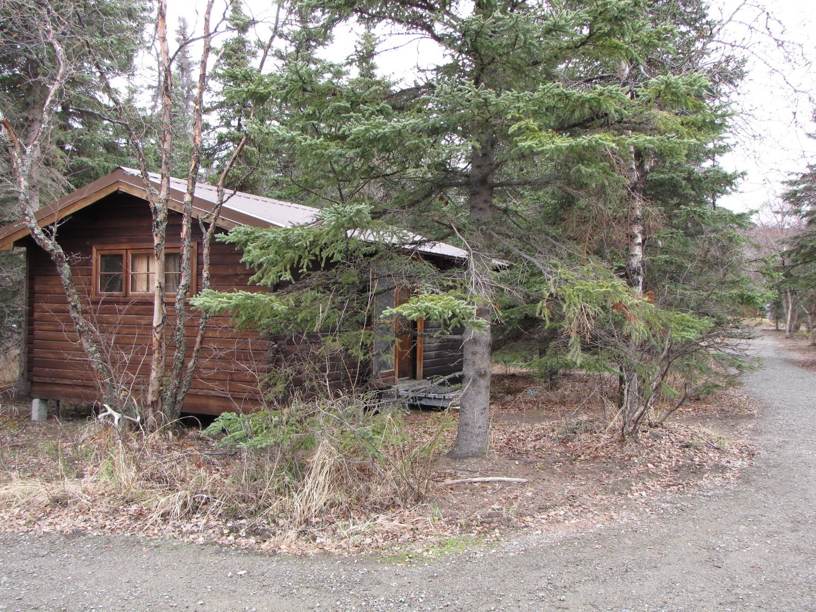
I wanted to give you, my fans and vicariously-traveling followers (you know who you are!) a look into my cozy cabin. As you enter the door and peruse the ambiance in a counterclockwise direction you will see the industrial-era dining table, frig, counter and sink with storage above and beyond, stove and pots and pans, a funky couch (didn’t we torch furniture like this back at Columbia TN in the 1980’s?), my nest, some stuff (pre-pink flamingo banner), and Cristina’s nest.
All in all it’s quite comfortable. There is a space heater that does a pretty good job of heating the entire place as long as the outside temperature isn’t below freezing. When we use the microwave we have to be sure our laptops are not plugged in – ditto with the hair dryer – or else someone has to go outside and reset the circuit. There is an ample supply of pots, pans, tupperware, dishtowels, and general kitchen stuff. There are metal cabinets in the sleeping areas for storage, and a reading lamp on a bedside table. Oh yeah, and small rugs are by the beds so our tootsies stay warm as we get up in the frigid mornings.
The bathroom is a few steps away from our cabin. I wondered at first about sharing this with 6 other women but it all seems to work out. It’s not like any of us are so high-maintenance. We be cool.
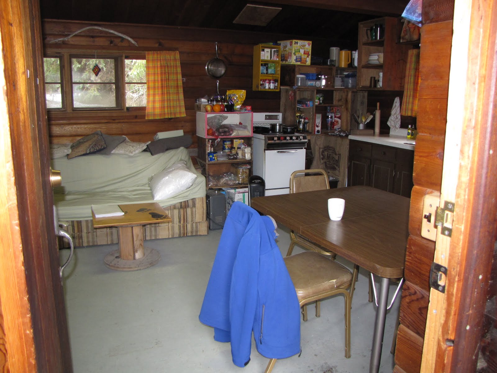
View Inside the Door
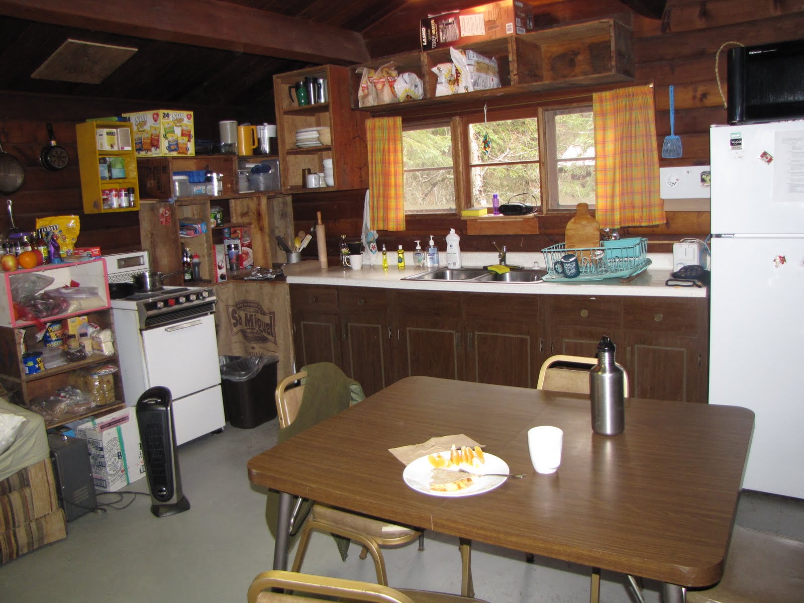
Kitchen Area
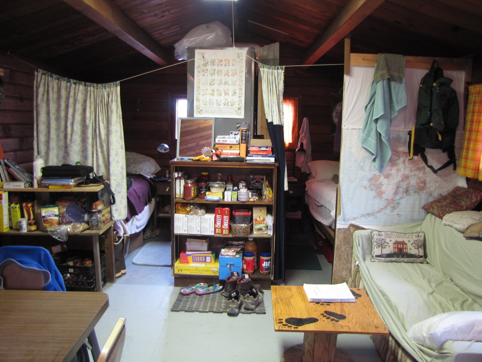
My Nest is on the Right
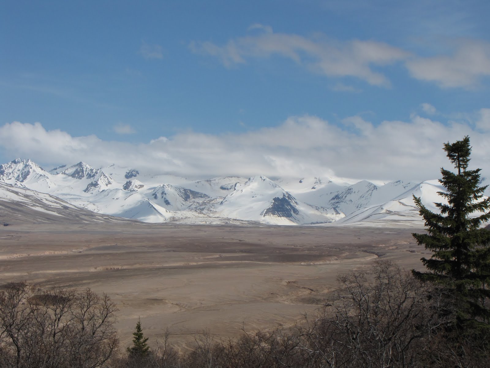
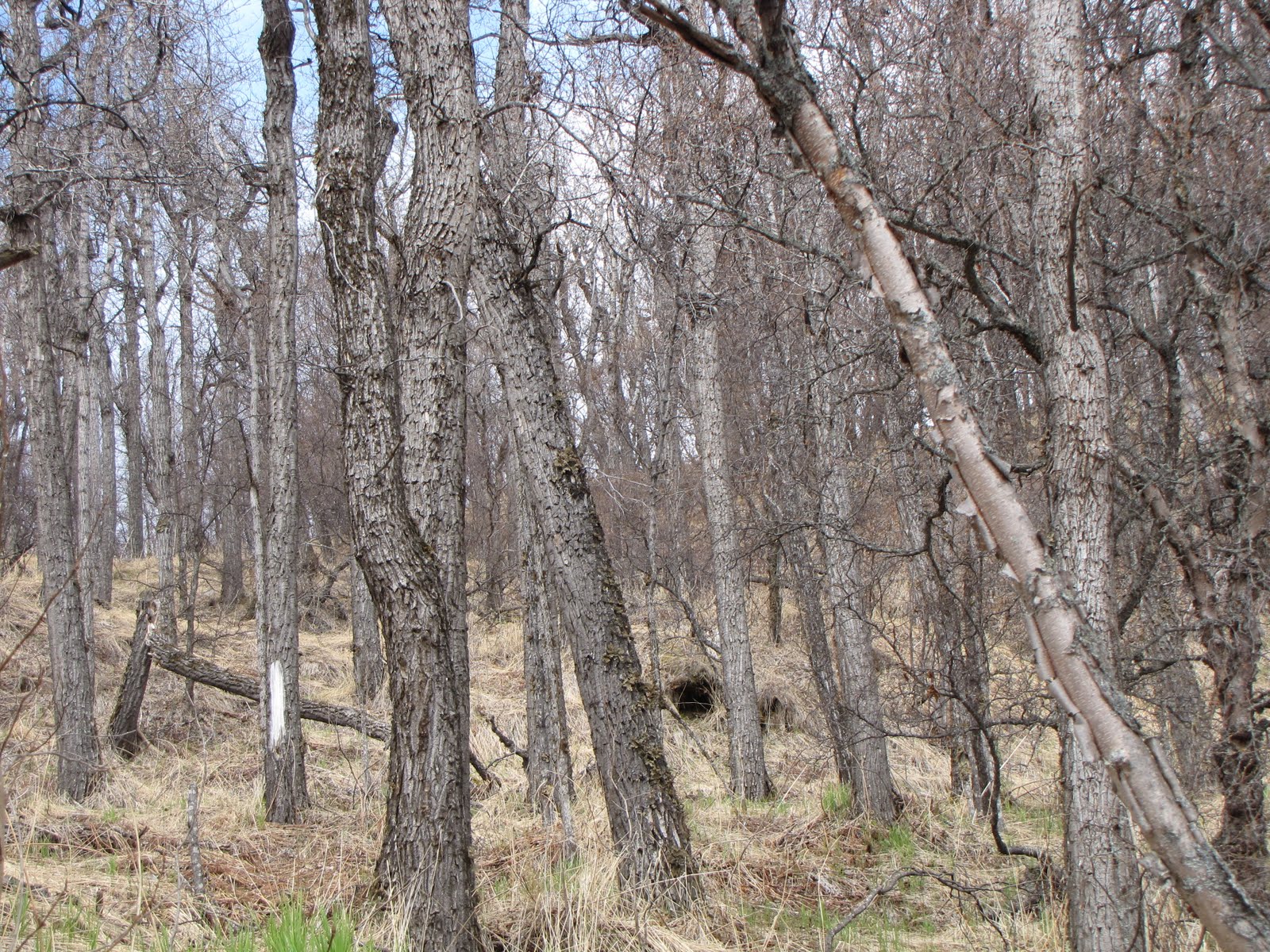
We arrived into the Valley of Ten Thousand Smokes this past Wednesday. Our journey took us from Brooks Camp through the low diversity/high density white spruce/cottonwood boreal forest of the Alaska Peninsula, across the treeless, marshy, sub-arctic tundra with its kettle ponds that told of past glaciations, and into the western foothills of the Aleutian Range and the “abomination and desolation” of our final destination.
I don’t know exactly how many people come to VTTS each year, but I know that I am extraordinarily lucky to be among their number. Better yet, I was getting paid to be here and would be expected, as part of my job as a Katmai NP interpreter, to act as guide to many summer visitors who were going to pay a lot of money to experience their own personal meanings in the geologic drama that is displayed so vividly at the Valley.
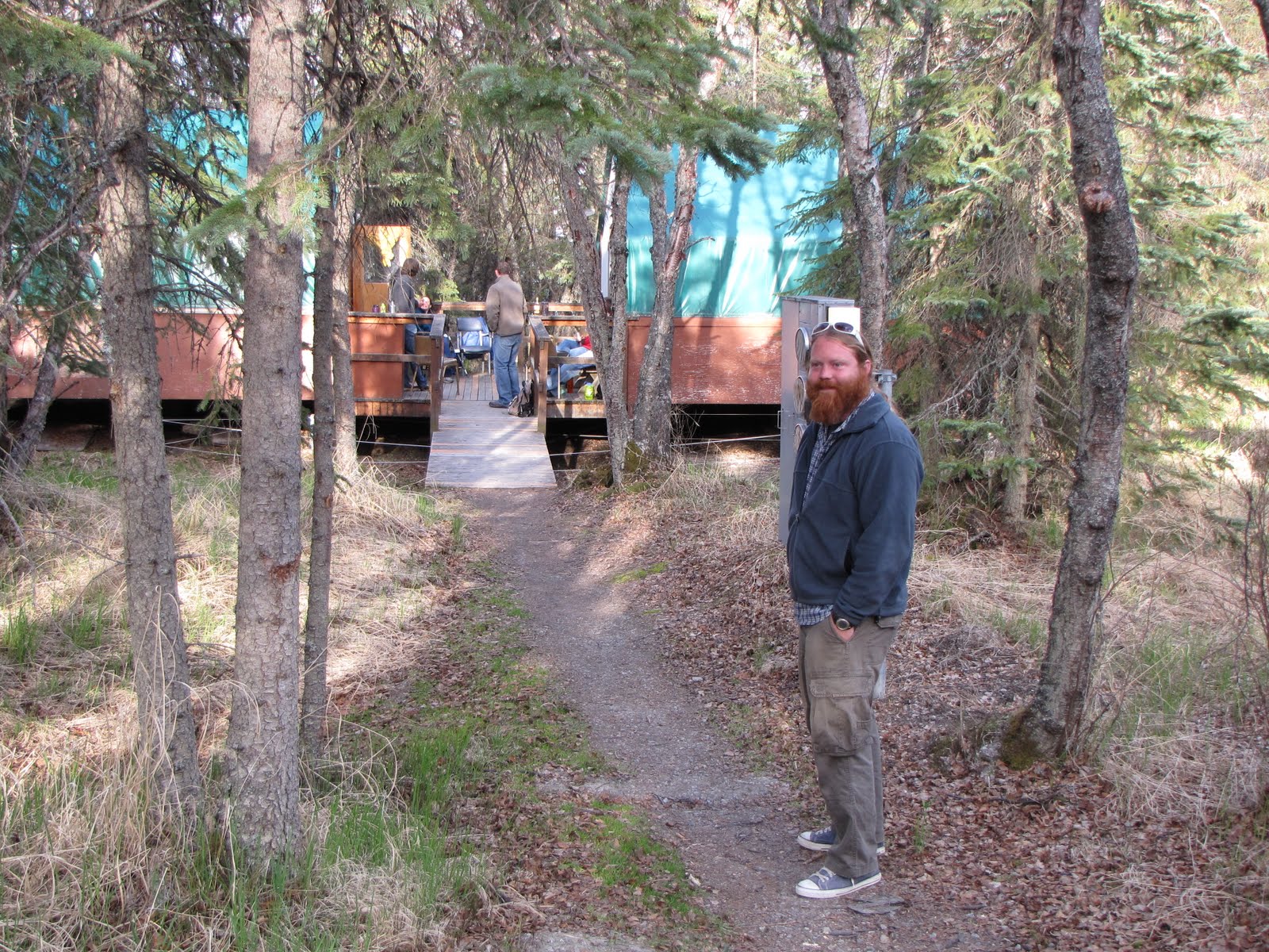
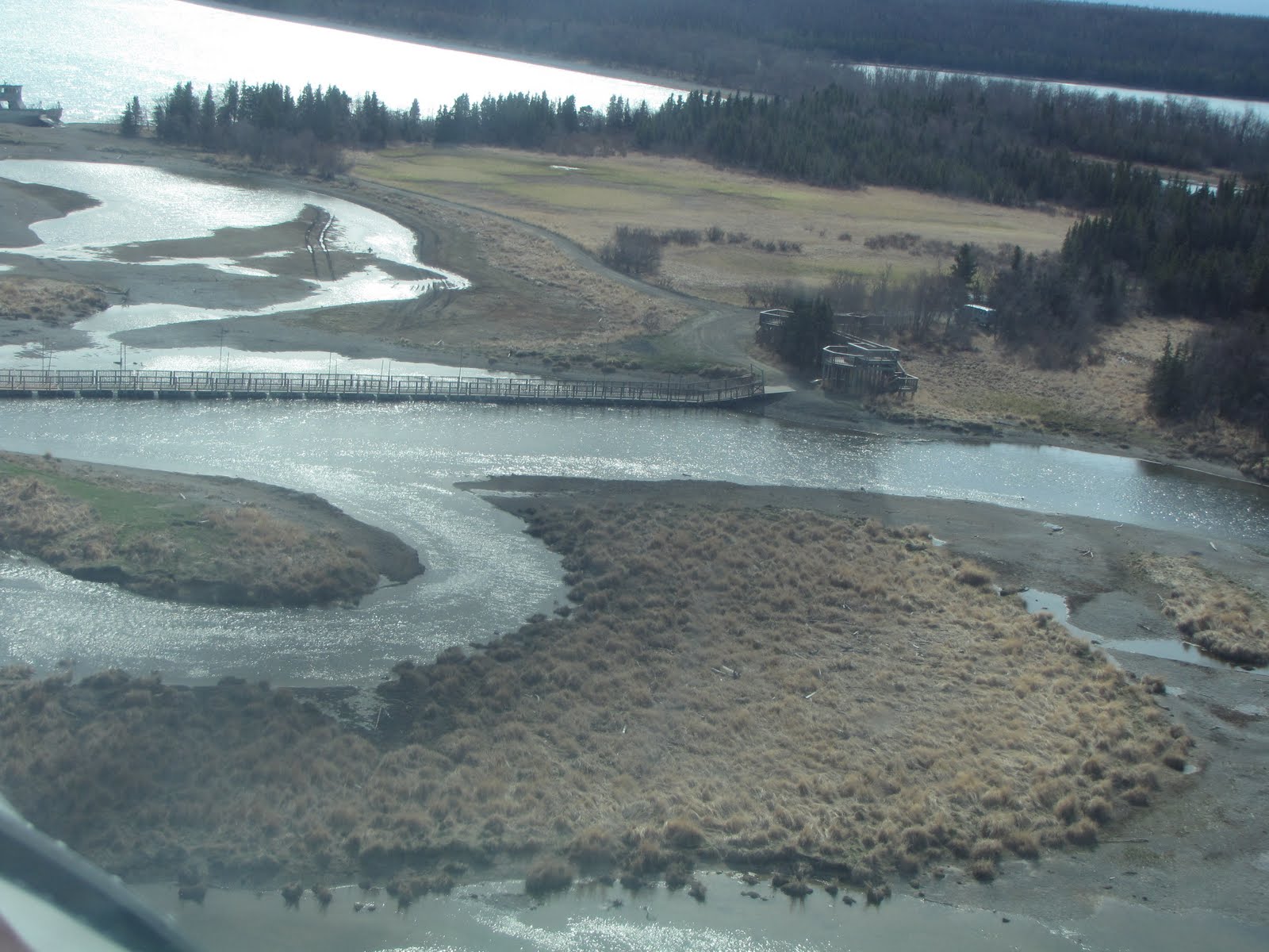
The plan was for our group of interpreters to hike 3 miles round trip from the unstaffed Three Forks visitor center to Ukak Falls and back, the same guided hike on which visitors will be taken, spend the night in or near (as is one’s preference) the visitor center, and then head back to Brooks Camp Thursday morning on the narrow 22-mile gravel highway that is the only maintained road in the nearly 5 million acres of the park.
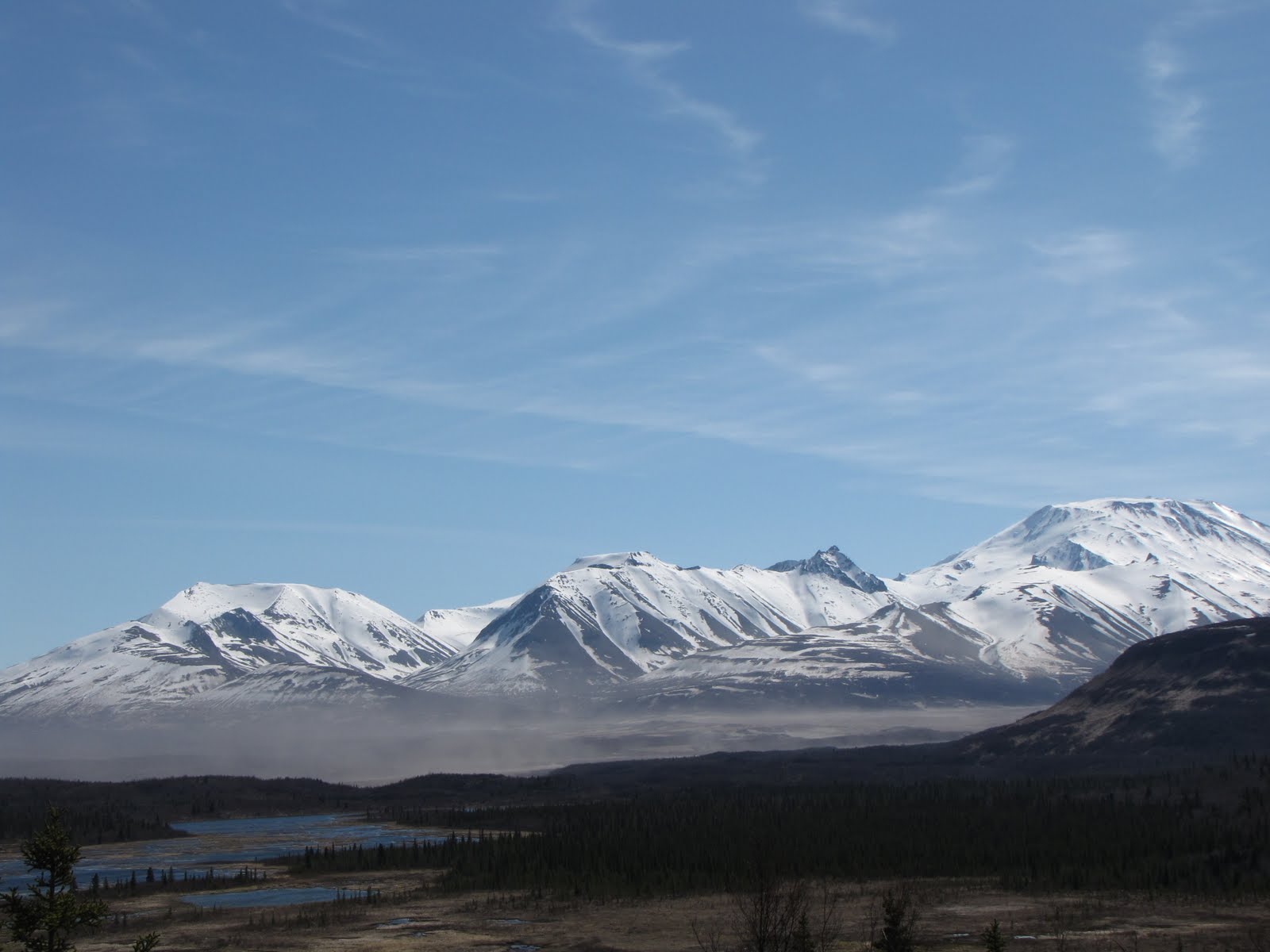
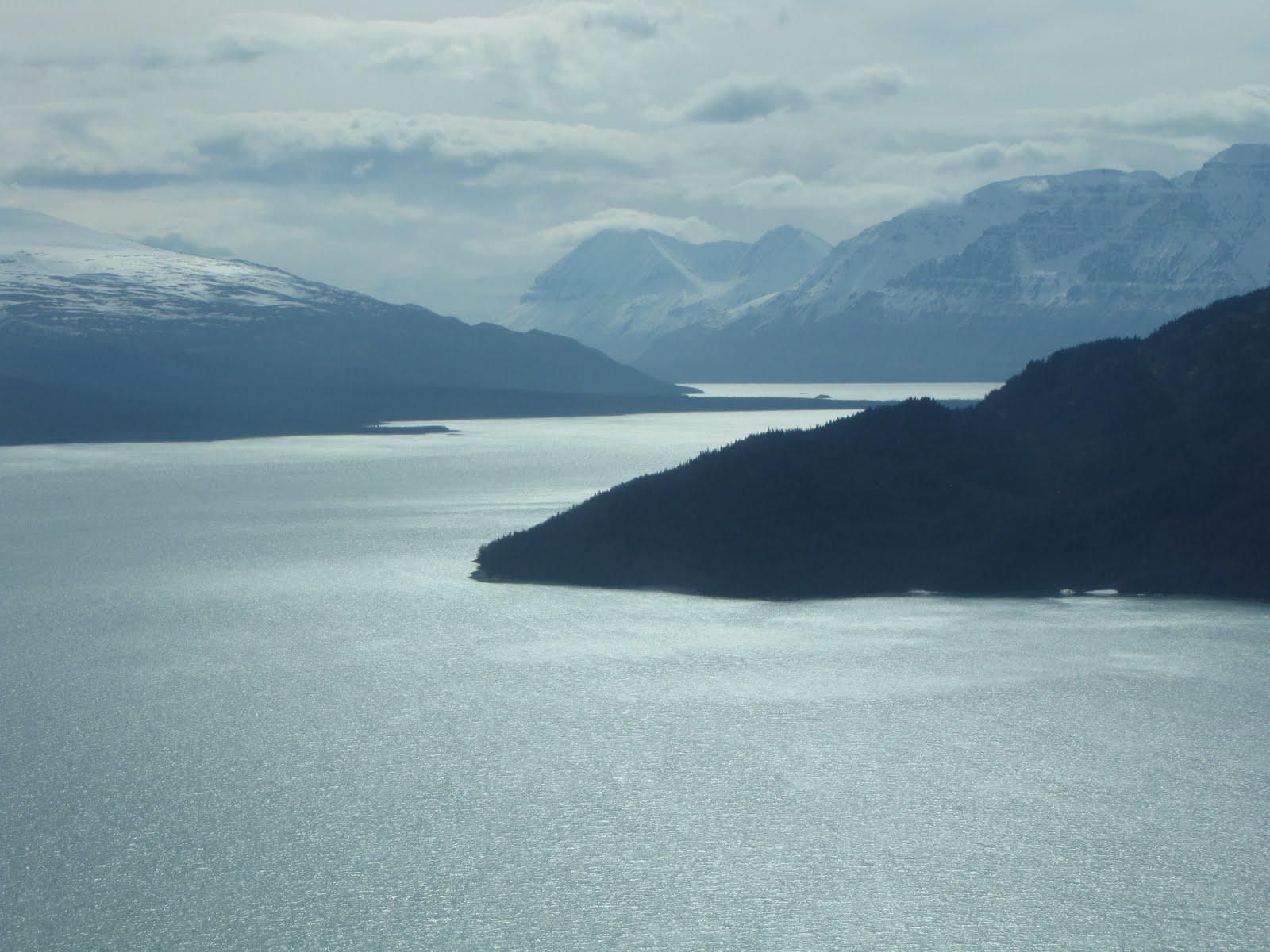
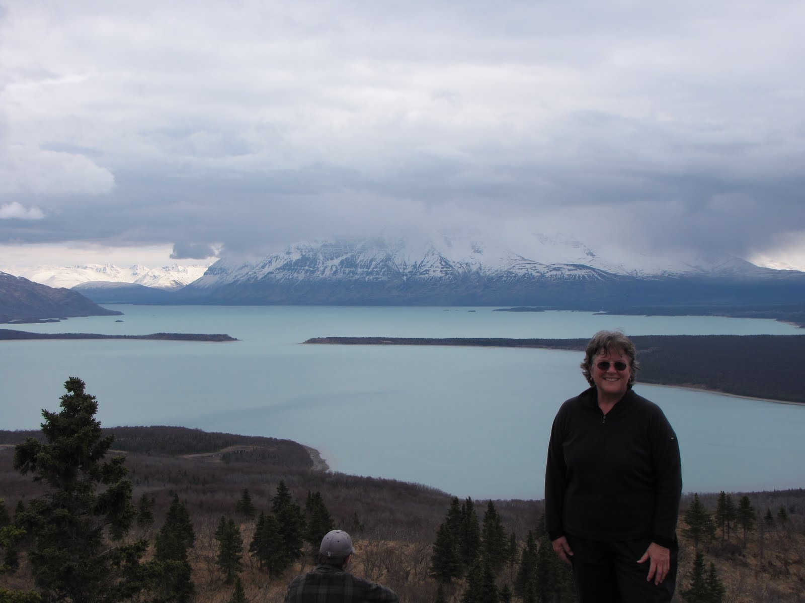
As we drove the Valley road we forded the river three times and paused at two places where we would be stopping with visitors. Mike (lived in King Salmon during the winter) offered us assistance on talking points so that we each might be able to formulate in our own minds an outline of what we would talk about at each stop. At Margot Creek Falls (we didn’t walk to the falls) there is a restroom (first things first!) and a ‘bear mark” with its huge footprints and a rubbing tree where the bears mark their territory and scratch their backs. We were experiencing a rare sunny day and so had exceptional views into Research Bay of Naknek Lake, Iliuk Arm, Mt. Katolinat (we would basically circle around its base – its many perspectives became our reference points), and distant vistas. I will never know the names of all the peaks in the area, but will only be able to learn the most distinctive and famous. There are so many mountain peaks in Alaska that most remain unnamed, particularly in the vastness of the wilderness areas.
 Kettle Ponds and First View of VTTS
In southwestern Alaska, evidence abounds of the sculpting power of past glaciers. From our first stop at Margot Creek we observed the ever-present U-shaped valleys, formed as the massive moving river of glacial ice, thousands of feet thick, scoured and battered its interminable way down from its source to its own terminus; at our second stop were kettle ponds, where huge blocks of ice had dropped from the glacier and eventually melted in place inside a ring of glacial sediment or till dropped as the glacier retreated, leaving the till and melted block of ice together in their present reincarnation as the kettle pond. The ponds were in the tundra, on a low divide somewhere between the two drainages of Margot Creek and the Ukak River. There were moose, swans, and beaver ponds, and we got our first glimpse of the distant Valley.
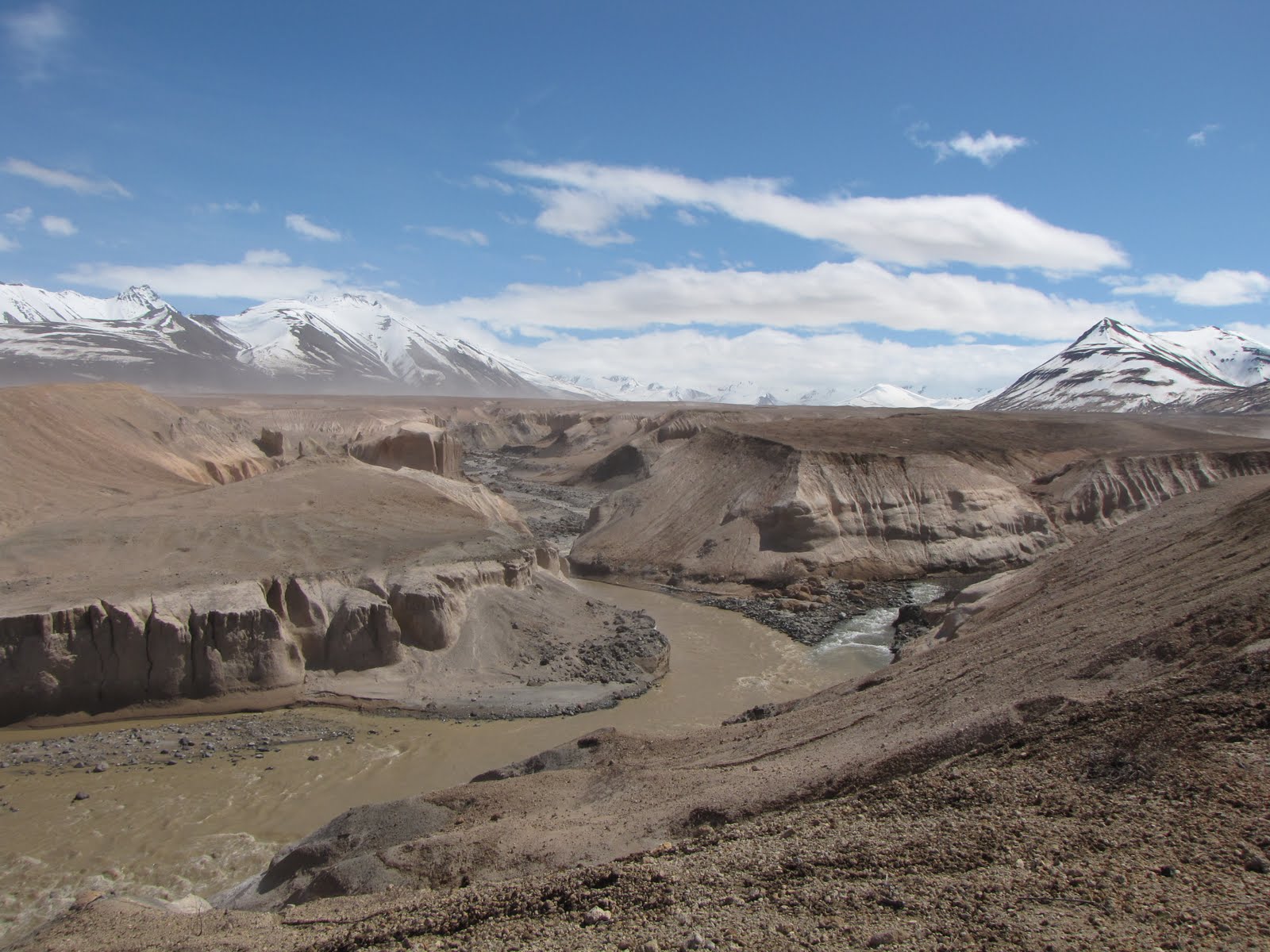
Before the volcanic eruption of 1912, the largest in the world of the 20th century, the Valley of Ten Thousand Smokes had been lush, green tundra with another name (I think it was called Knife Creek Valley), much like the tundra which was presenting itself before us now. But on June 9, 1912, after almost 3 days of relentlessly explosive volcanic activity, the Plinian eruption (very gas-rich and explosive) finished its venting, the intense activity ceased, the magma chamber beneath Mt. Katmai and Novarupta had emptied (for the time being, anyway), and the landscape was changed forever.
There is so much I could describe here – ash dunes constantly shifting, rivers blasting their way off snow-covered mountains and carving sinuous paths through hundred-foot cliffs of rhyolite ash, fossil fumaroles, the contact between the pyroclastic ash flow and the bedrock of the Naknek Formation, the wind screaming its way across the Valley, wolf and moose and bear prints, the beauty and desolation of it all. For now, I am able only to offer a few photos but hope that these will suffice temporarily, and I sincerely hope that your imagination can bring you to this place where I have been and to which I trust we can all, in one shape or form, return this summer.
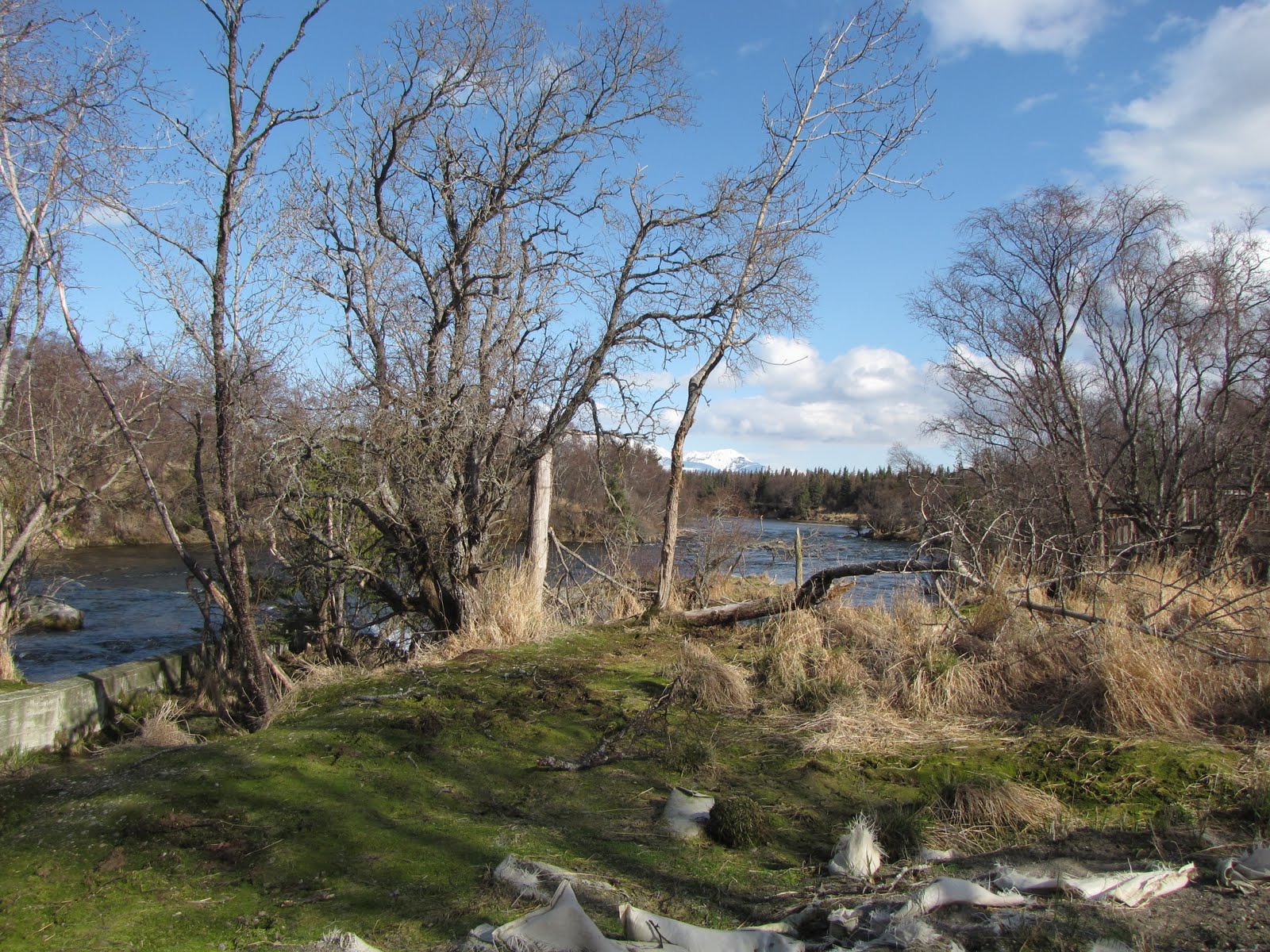
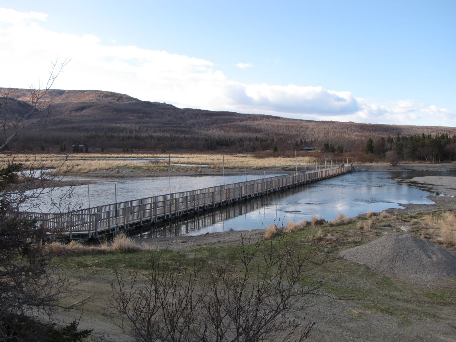
So we followed Mike along the trail, 800 feet down into the Valley. Again he stopped often so as to give us ideas and encouragement in outlining our own ideas for our guided hikes. Before we got to the falls we decided on a ½ mile detour to the Confluence, where Windy Creek, River Lethe, and Knife Creek all come together to form the Ukak River which ultimately carries its high-energy sediment load into braided streams that drain into the Iliuk Arm of Naknek Lake. Here were rhyolite ash cliffs 20-30 feet high at least, the ash-silty waters roaring below us. The wind was screaming and I felt really sorry for all the contact lens wearers in the group (been there, done that). I was chewing on grit by this time but was nearly delirious to be at that place.
Confluence
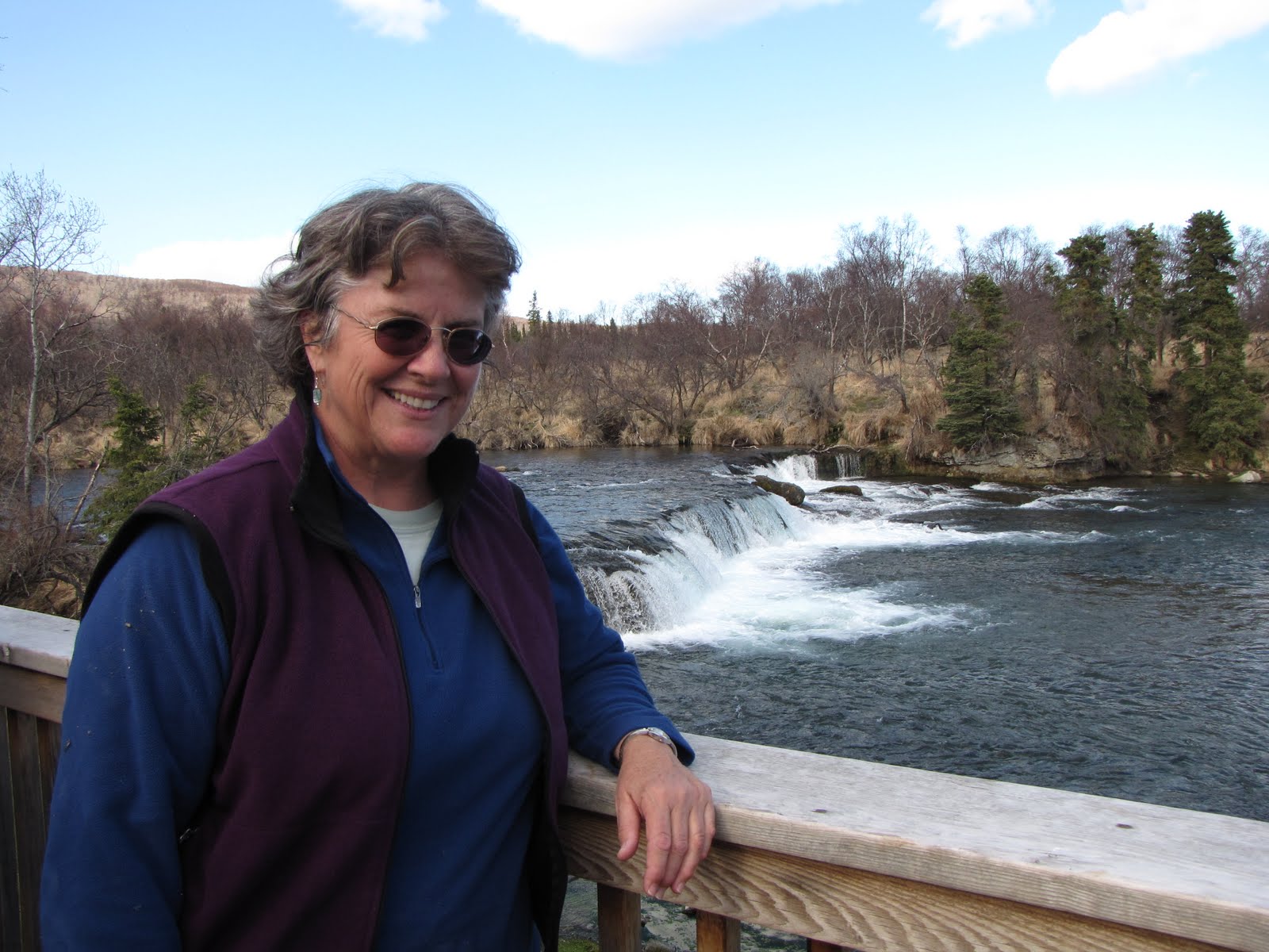
Ukak Falls carves through the ash and underlying bedrock of the Late Jurassic Naknek Formation (about 160-146 million years old). Here were the famously-abundant hard-shelled fossils of Buchia pelecypods (clam-like critters). I also spotted some straight-shelled ammonite casts scattered about in the bedrock. When I pointed these out to my fellow interpreters they became excited about being able to recognize something previously unknown to them. The Naknek Formation is the oldest rock unit exposed in the eastern part of Katmai and tells a story of inundation of the Katmai region by a progressively deepening ocean. I have as my constant companion “The Geology of Katmai National Park and Preserve” by Jim Riehle, from which much of my geologic knowledge of the area has enthusiastically been obtained.
I moseyed back to the visitor center on my own, lost in thought about what I had seen and done but also singing and carrying on a conversation with myself out loud (Nothing new here! There go those voices in my head again.) and looking around –this is bear country. There was no rush, after all.
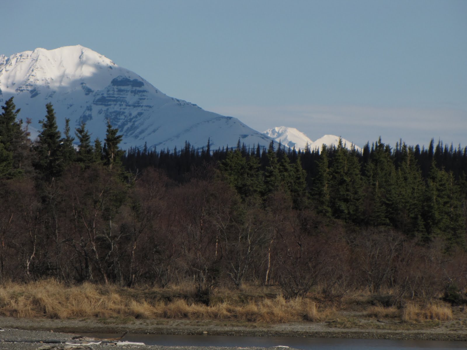
We had our Park-supplied carbo-loading dinner of couscous and tortellini cooked over the Coleman stove as the late evening sub-arctic sun began to cast shadows on Mts. Griggs, Katmai, Mageik, and so many other named and nameless peaks of the Aleutian Range. I set up my “nest” in a corner of the floor away from the card-players and settled down to read for a while until I fell asleep. I have gotten pretty good at sleeping during daylight hours which seem to (and really do) last forever in these Alaskan summer days. Phil and Kent slept outside on the deck and in the morning I asked them if they had seen any stars, particularly the Northern Star, during the night. They said they had seen one or two measly stars but that was about it.
They both related how the night never really got dark, even for a few hours. It helped to picture in our minds eye the outline of a circle representing the orbit of the sun in the sky. We imagined this circle-outline at a right angle to the horizon such that just a very little portion of the circle-outline is hidden beneath the horizon. Kind of like when the sun is just setting over the ocean there is a small piece of the sun below the horizon. That is what the night is like at this time of the year in Alaska. Dusk is present from sunset until sunrise – the sun rises early, goes up high in the sky and then sets late. It never really gets dark, even when the sun is below the horizon for that short time. I have long known that high-latitude daylight has to do with the angle of the Earth during the different seasons, but I’ve always had a good bit of difficulty conceptualizing this until the other night at Three Forks visitor center. And so it follows that during winter, the circle is flipped so that the majority of that same circle is below the horizon.
Thanks, Alaska. I owe you one.
VTTS with Knife Creek Glacier

FRIDAY:
Around 8:00 a.m., as I was standing by the window pouring myself a second cup of coffee, I heard the words we all have been anxiously waiting to hear: “Bear in Park Avenue!”
Park Avenue is the name of the path where the Park employees’ cabins are located. All the paths in Brooks Camp have names (generator trail, campground trail, bear trail, lodge trail, and so on) so that when there IS a bear anywhere in the Brooks Camp Developed Area, its location can easily be referenced by those fortunate enough to be inside a building at the time of the sighting. Interpreters are not required to leap out of their cabins to help motivate the bear to vacate the camp area (to go onto the beach, for instance) but are actually encouraged to stay inside. Those souls who are fortunate enough to be hired on as “bear managers” have this privilege. So I am not sure who the “shouter” was this morning (anyone can shout, in fact) but I heard shortly afterward that the bear had motivated itself on down towards the generator trail and hopefully onto the beach or at least out of camp. There was apparently also a second bear that had toodled off before someone could watch it.
The bears are managed mainly to keep them out of the developed area of the Park cabins, visitor center, ranger station, and the Lodge and its cabins. The beach and the river belong to bears, and one of the interpreter’s jobs is to help facilitate visitor travel across the footbridge and through the “high food resource area” of the river. It’s often when the bears try to take a shortcut through camp that the fun starts.
Even though the salmon haven’t migrated into Brooks River just yet, there are a couple of early-bird bears who just can’t resist showing up and lolling around on the beach, feeding on less-than-nutritious grasses in the surrounding wetlands and wandering through camp. Some of the returning bear managers think they can identify bears of yesteryear. “Oh there goes #602” they say assuredly. Well, they may know their bears. But I know my rocks.
Friday was our last day of orientation. Woo Hoo!!! The next time we show up for work (Tuesday June 1, after the Memorial Day holiday) we will be in uniform. There are no Smokey the Bear flat hats for the Katmai crowd, either. We get to wear winter ball caps, mainly because they tend to stay on your head better in the frequent 30-50 mph winds that can blow through here later in the summer. I was able to buy a Park Service gore-tex parka with my $160 uniform allowance, but I had to use my own money for the liner.
We had an all-employee meeting Friday where the superintendant, chief ranger, chief of interpretation (my boss), chief of resources, accounting (does payroll!), maintenance and others talked about what projects their department is/has been involved in for the fiscal year. Now we get to kick back and enjoy the 3-day weekend. I decided to not go backpacking this time around but am staying in camp to read and work on my programs, do a little hiking, blog, and just enjoy having my cabin to myself (even though my cabin mate is very nice). About half the camp is gone for the holiday, so an impromptu potluck was thrown together Friday night by the rest of the Park interp, resource management (bears), and law enforcement folks who were hanging around. We cooked in our own cabins and then got together outside between 2 tent cabins. These are some game-crazy people, so afterwards we got together to play a mildly enthusiastic game of Wilderness Survivor. I could have gone to bed hours before I did!
Bear Tech Justin
We’re blowing through orientation like a freight train rolling downhill. Tuesday morning we practiced our stand-up “bear orientation” routine on each other. It was only slightly painful! “Welcome to Katmai National Park and Preserve! My name is Nina. Don’t run when you see a bear! Have a nice visit.” Well, there WAS just a little bit more to it but you get the idea.
After lunch we followed the park archaeologist around while he interpreted more on the prehistoric inhabitants of the area. Northern Archaic (interior) – Arctic Small Tool – Norton – Thule. From 5000 years ago onward, these are the names that have been given to the early peoples of the Alaskan Peninsula. Very interesting day. We slogged around for a few hours along the ancient river terraces that were long ago a submerged earlier post-glacial (≈ 10,000 years ago) Brooks River, emerging as dry land only as the glaciers gradually receded. We were looking for the depressions in the ground that would indicate evidence of another semi-subterranean winter dwelling.
If the road is clear and dry enough for travel, we will go on our Valley of Ten Thousand Smokes tour on Wednesday 5/26 and spend the night in the Three Forks visitor center. Updates to follow!
Sunrise 5/25 was at 5:34 a.m.
Sunset 5/25 is at 11:07 p.m.
There seems to be a lot of light in the sky in between these times. Tuesday afternoon the sky finally cleared of clouds after 5-6 days of southwest Alaska overcast skies and cold drizzly rain. I would really like to see where the North Star is at these latitudes. Maybe I will be able to have an unobstructed view at Three Forks when we go.
My Cabin at Brooks Camp
Uh Oh. I may have seriously drained the bandwidth yesterday by sending all those photos. It probably wasn’t just me, but from now on I may not be sending pix with each blog post. However, that means more blog posts! I am going to try and make my posts shorter and more frequent. This may mean only 1 or 2 pix at best each time, however. I know – so sad. But we will endure!
My photos are kept in folders – I download them pretty much as soon as I take them (or at least really soon) and then label each one, lovingly and carefully! I take many more pix than I post. I am so organized it’s scary.
These people with whom I work love games! We played Katmai charades first thing Monday morning for about 30 minutes. If we were a Japanese car company we’d be doing calisthenics every morning. Personally I think it’s a stall tactic by the supervisors until they figure out what to do with us. We also play “Catchphrase” a lot – Kind of like Pass Word but for Park geeks. A lot of people play cards in the evenings but that isn’t my thing. I did get caught up in a card game of “BS” a week or so ago, which turned out to be lots of fun. However, I just can’t get over wanting to go into my room and read.
Actually, I am really impressed with the month-long orientation they give you here at Katmai. It is very thorough and these supervisory folks know what they are doing. After Charades we reviewed “conducted activities” which are different from a formal evening illustrated (Power Point aka Apple Key Note) talk in that we take visitors on a 1/2 mile walk to a reconstructed pre-historic dwelling at Brooks Camp and do an informal interpretive presentation along the way. Again we are allowed to choose our own theme for this walk. Documented human history goes back 5000 years in the Brooks Camp area, with 900 identified habitation sites.
So, besides the extraordinary geology of the Valley of Ten Thousand Smokes, there is the archaeology. I am thinking that a theme for my walk might be along the lines of why Brooks Camp even exists where it does – the historic camp as part of the continuum of 5000 years of human habitation along the Brooks River. It’s certainly no Mesa Verde or Chaco Canyon, but there are visible remains of dwellings (that are just depressions in the ground) called barabaras dating from around 1050-1400 a.d. I definitely need to do more reading if I am going to try and help make any of this meaningful for the visitor.
We also started in on actual “bear management” training – which by rights ought to be called “visitor management” since we do not manage the bears. They do what they want unless they come too close into the cabin/lodge/visitor center area and then there is some mild hazing (“Get out of here, bear!!!”) until they leave the area. All they are trying to do is take the shortest route to the beach or the river and that is often through camp.
The beach and the river belong to the bears.
The weekend has arrived – and with it, the end of the 3rd week of my summer season with Katmai National Park and Preserve. On Tuesday, the day the interpretive staff was to fly out of King Salmon, I was walking down to the dock from the dorms with Phil, another interpreter. Just taking it easy and slow, enjoying the rare crisp-blue-sky southwestern Alaska morning – we had a bit of time before Alan, the Park pilot, brought the floatplane back from its first run of the day to Brooks Camp. I was scheduled to go on the second run. As we moseyed down the path to the river, Phil commented that “This summer is going to just fly by.” Yes, indeed.
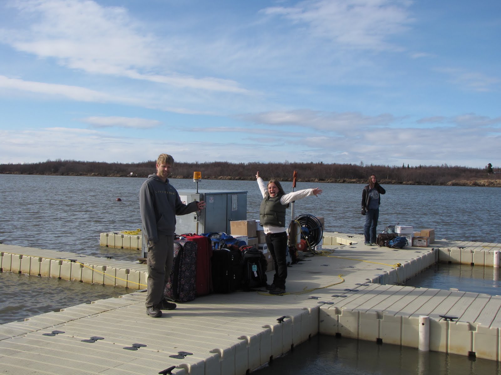
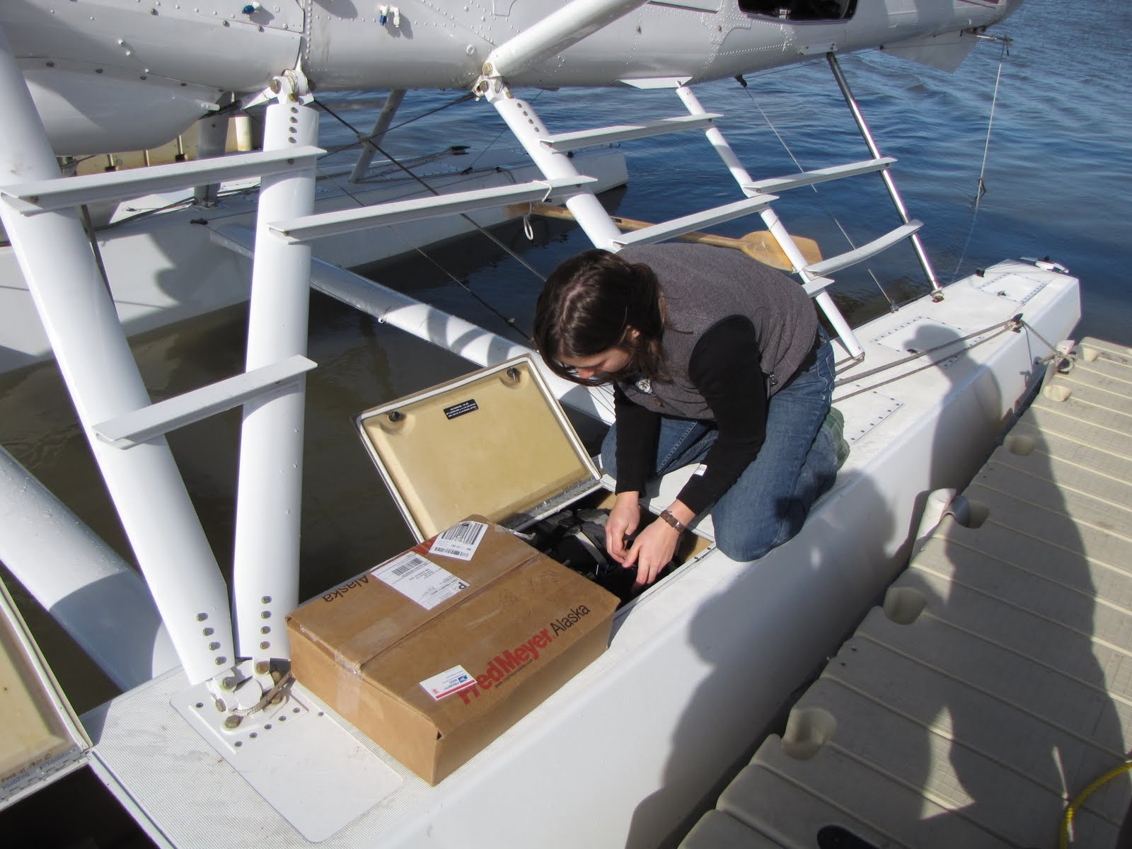
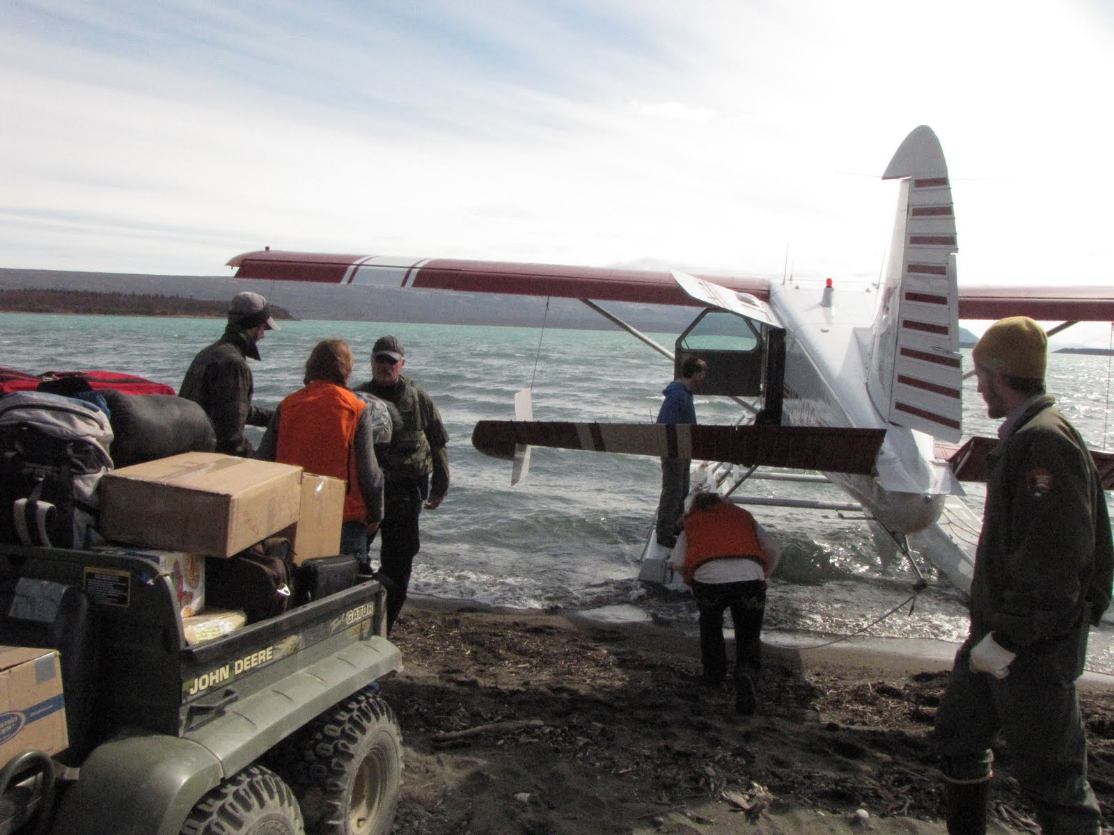
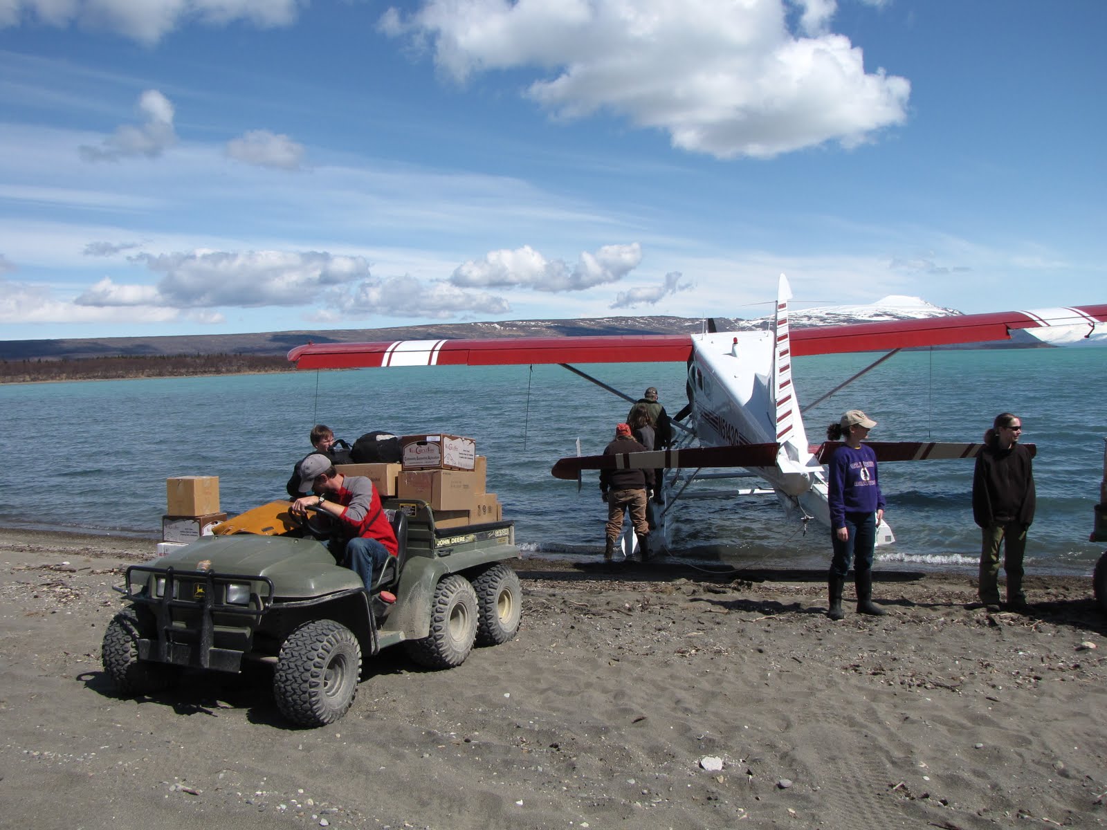
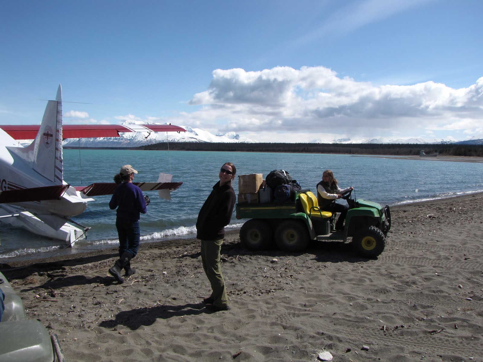
Moving everyone’s STUFF was poetry in motion. People who had never worked at Katmai before were not really sure how it was all going to play out. In the end it became like a snowball rolling down a mountain, gathering momentum and energy as it traveled its path in space and time. Or maybe we were all pushing the snowball UP hill, 19 or so people cooperating and in tandem anticipation, to make it to the top, to the peak, to get us and our STUFF to Brooks Camp. Everything was moving steadily and surely towards its own destination – people along with their treasures, whether it was a laptop computer, 5 boxes of wine, 9 pairs of socks, a caseload of Rock Star, or 13 frozen pizzas to last through September.
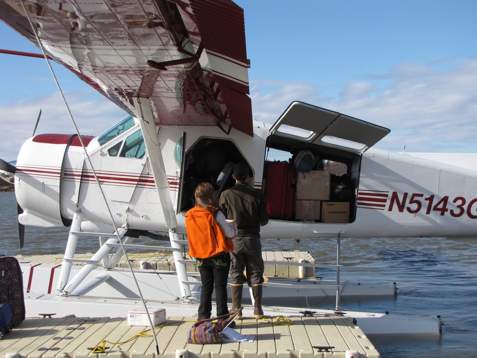
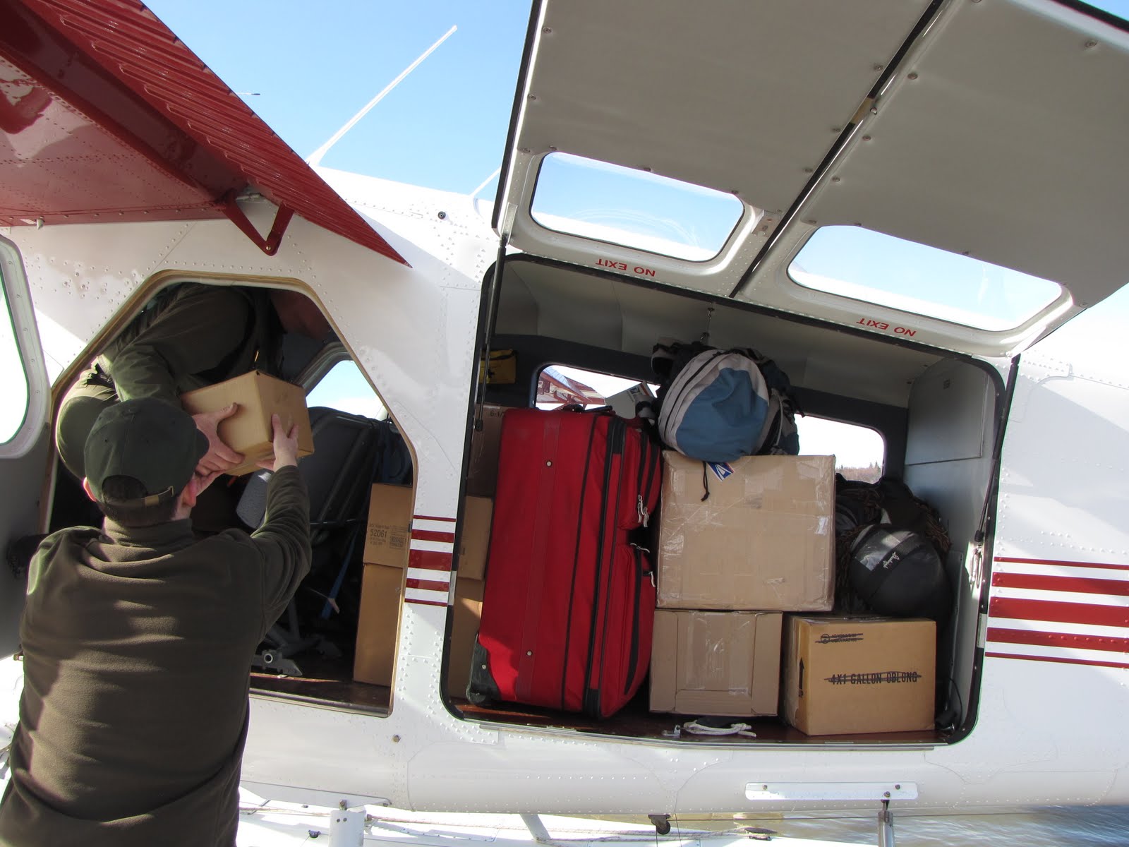
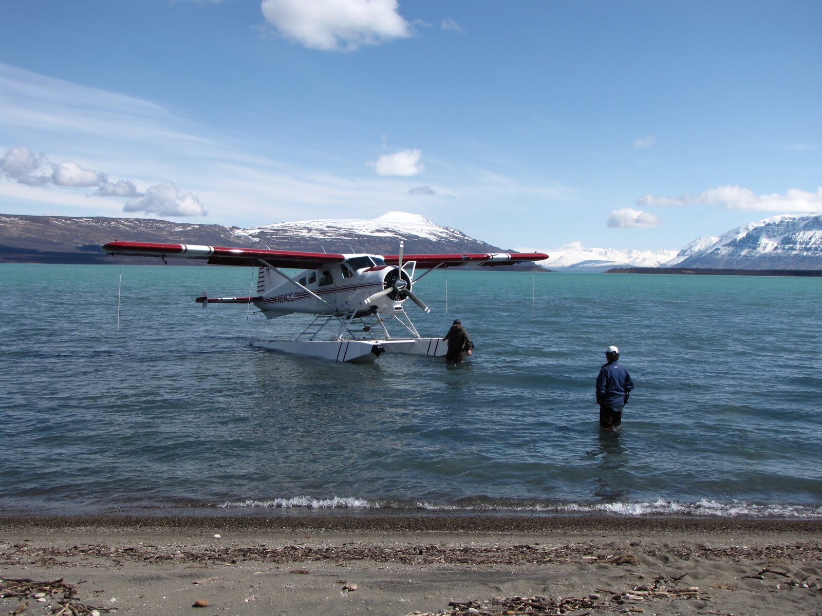
We helped as Alan arranged our STUFF into both the floats and the baggage compartment, passing boxes yet again one to another until each box was in its correct weight-balanced position, ready for the ride.
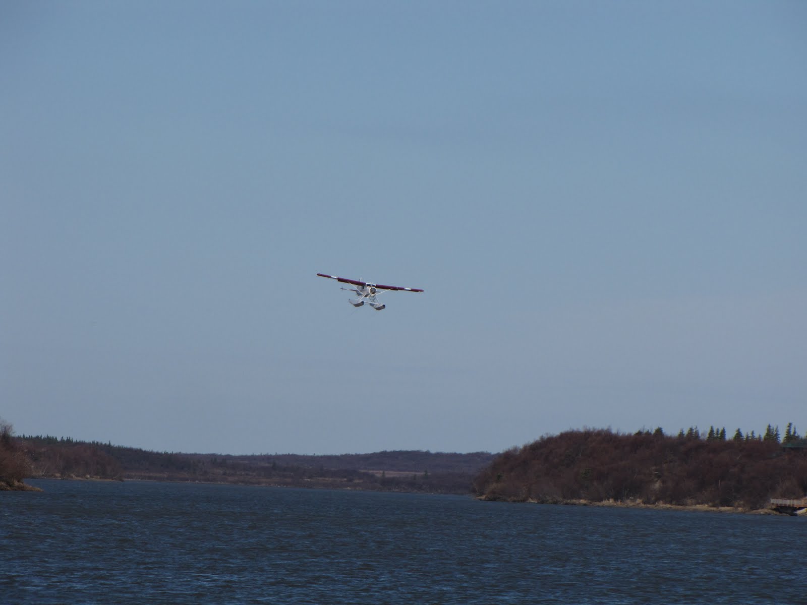
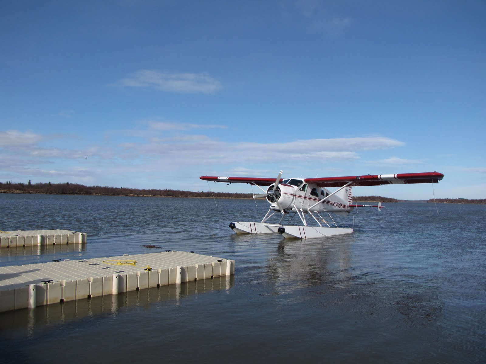
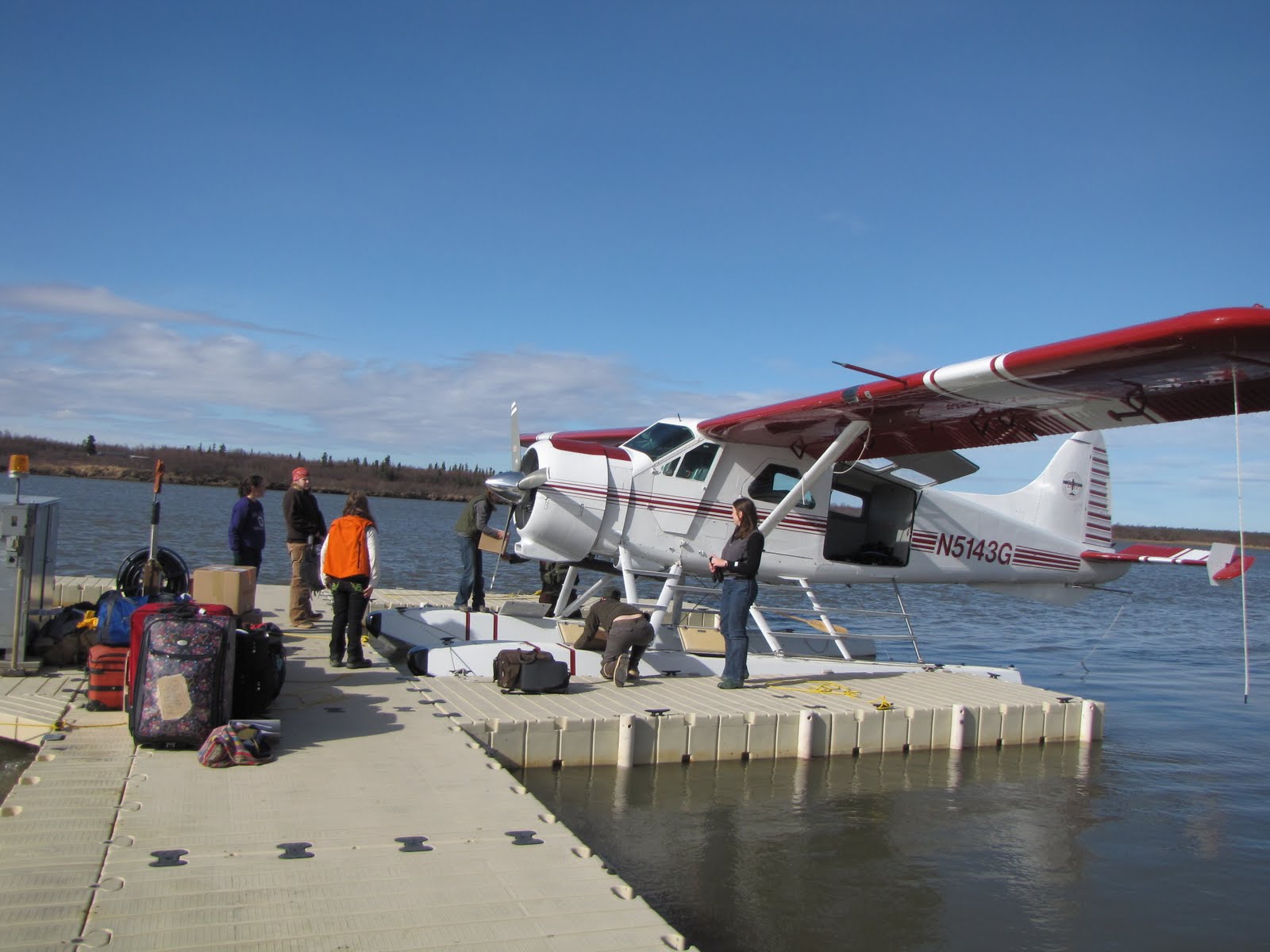
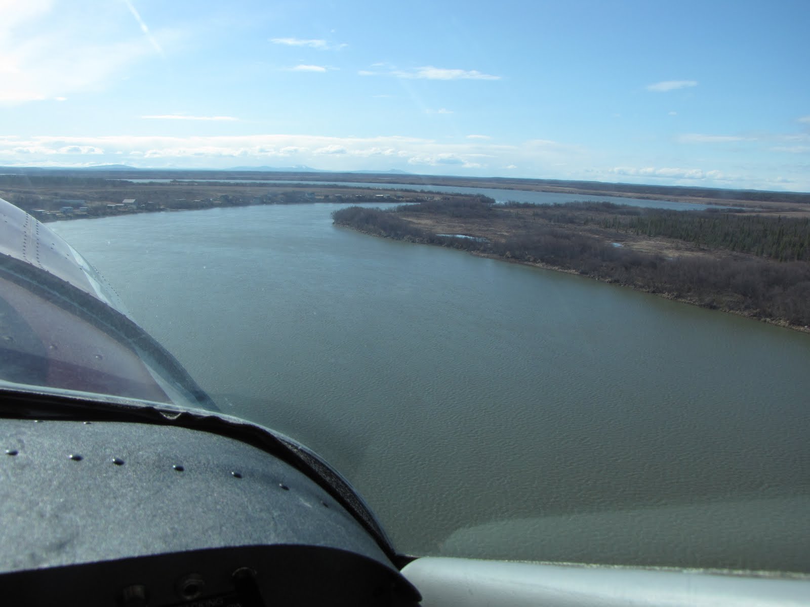
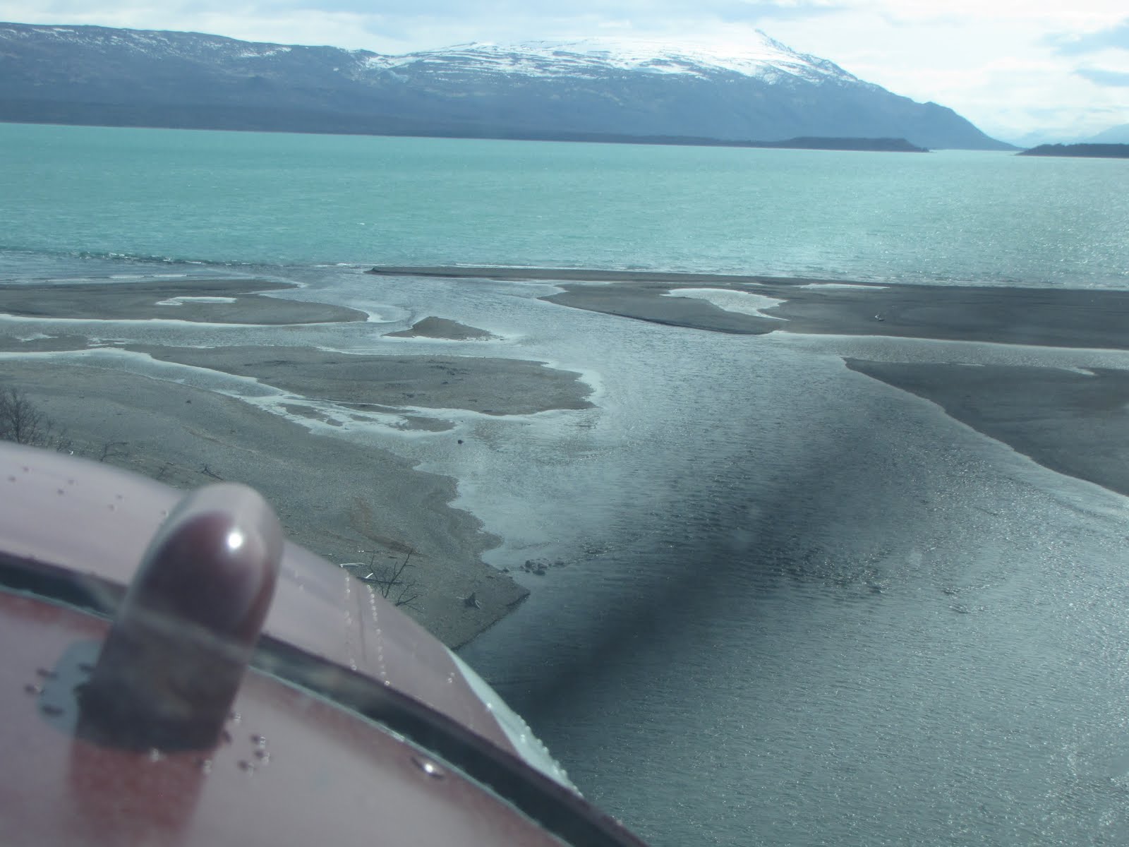
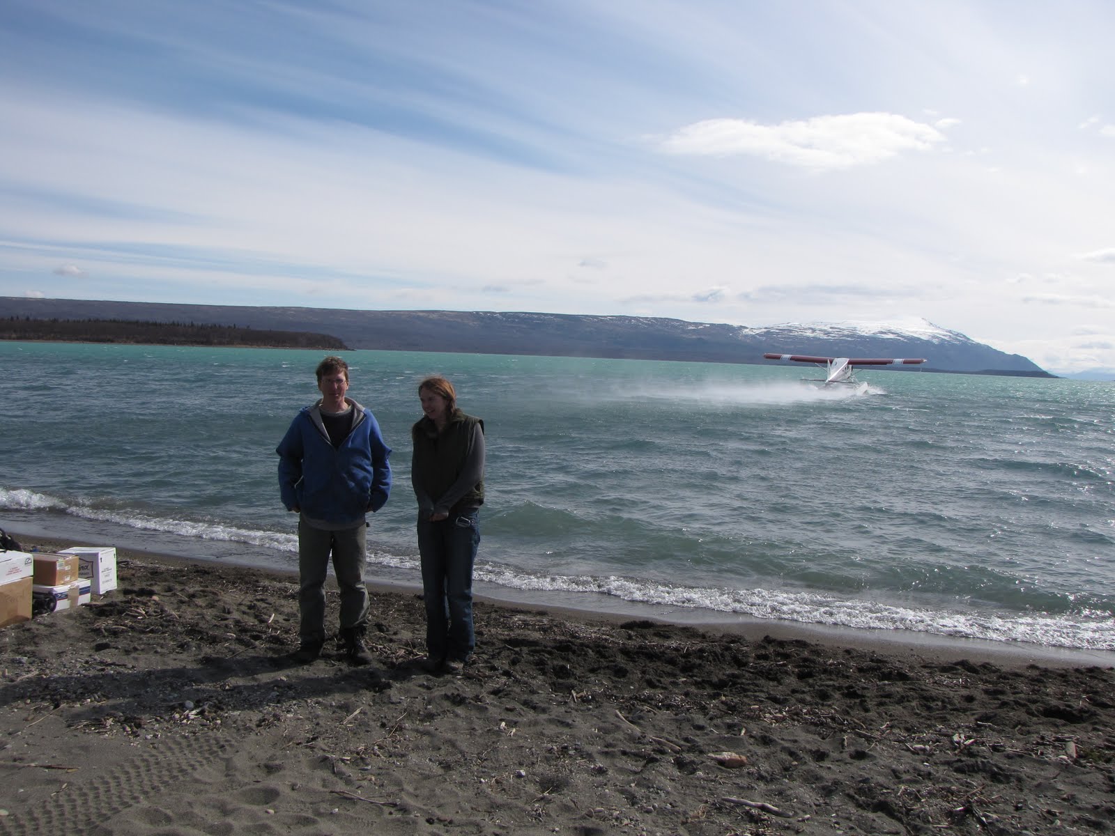
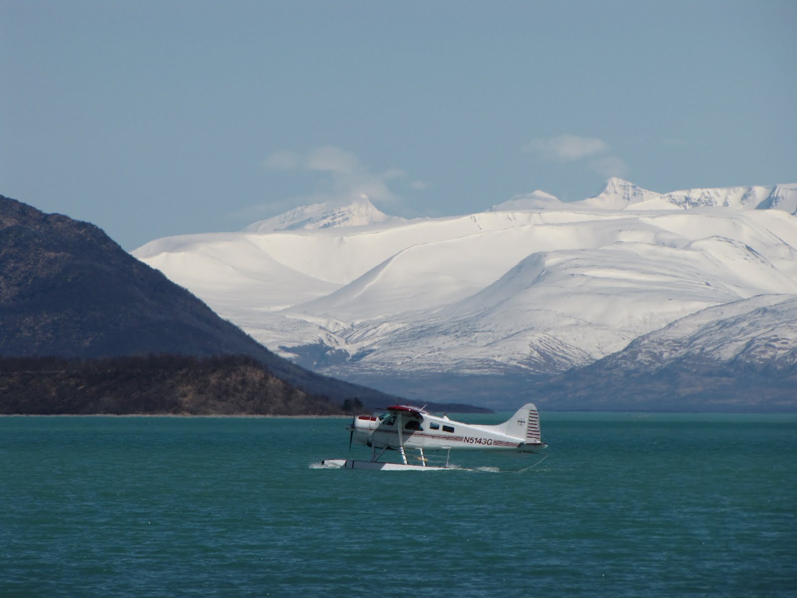
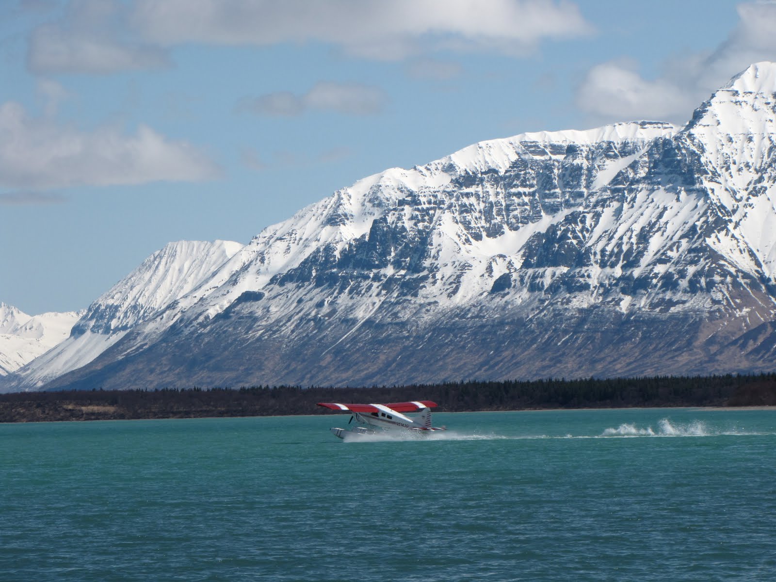
Once again I climbed into a plane, this time a DeHavilland Beaver fitted with floats for water landings, larger than the Cessna 185 but still cozy since we were all required to wear life jackets that were packed with survival gear (which pocket are those flares in???). This time I was able to score the front passenger seat! There was a light wind moving downlake as we lifted up off the waters of the Naknek River, eastward and into the wind, bound for Brooks Camp 40 or so miles away where the Brooks River flows into Naknek Lake. We were doing it! One week later than originally planned, we were at last on our way.
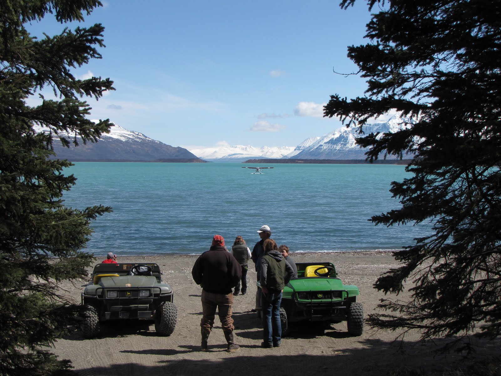
When we arrived at Brooks the ballet came together again, this time in reverse as the plane was unloaded by the three passengers and one pilot along with the three interp staff members who had flown out first. We had come in low over Dumpling Mountain and banked steeply, mere inches it seemed over the Brooks River, the falls, the bridge, the bear-viewing platform overlooks, the cabins, and the lodge. There it was! It was honestly a thrill for me to see the others waiting for us on the beach as we made our final approach to a landing on the lake.
After unloading the plane on the beach and watching it take off empty across the water for its return journey to King Salmon, we had time to start unpacking our own boxes and arranging our own cabins until once more Alan and his float plane returned with its precious cargo of Katmai interpreters and all their STUFF. This went on throughout the rest of the afternoon until eventually all who were supposed to leave King Salmon that day did so, and all who were supposed to get to Brooks that day had gotten there. Soon it was time to thank Alan, to say farewell for now, and then off he flew once again across the lake and back to King Salmon, disappearing into the sky around the low curve of Dumpling Mountain.
I couldn’t believe it, but after all that work and being so fatigued and dirty, everyone still wanted to go for a walk to see the hoopla that is Brooks Falls! No, we didn’t see any bears but we did see some fresh prints on the beach and some of last years’ prints along the bank of the river at the falls – jeeez those paws are huge!!! We also closely examined quite a few old piles of bear poop (Well, of course we did – we’re interpreters! We have to interpret the poop for the public! Lots of tiny salmon bones, btw. No surprise there, eh?).
We were kept pretty busy for the rest of the week. I get up around 6 a.m. and have the morning to myself until around 7:30, often walking down to the beach to say good morning! to my day. I am really jonesin’ to take a cup of coffee with me but we aren’t allowed to take any food or drink except water (and not flavored, either!) out of our cabins – visitors can’t take sodas or granola bars or anything out on the trails – because in order for Katmai to work, the bears can’t be allowed to make any sort of connection to humans as a food source. This is pounded into us in orientation, and we will do our bleeping best to pound it into the visitors when they come.
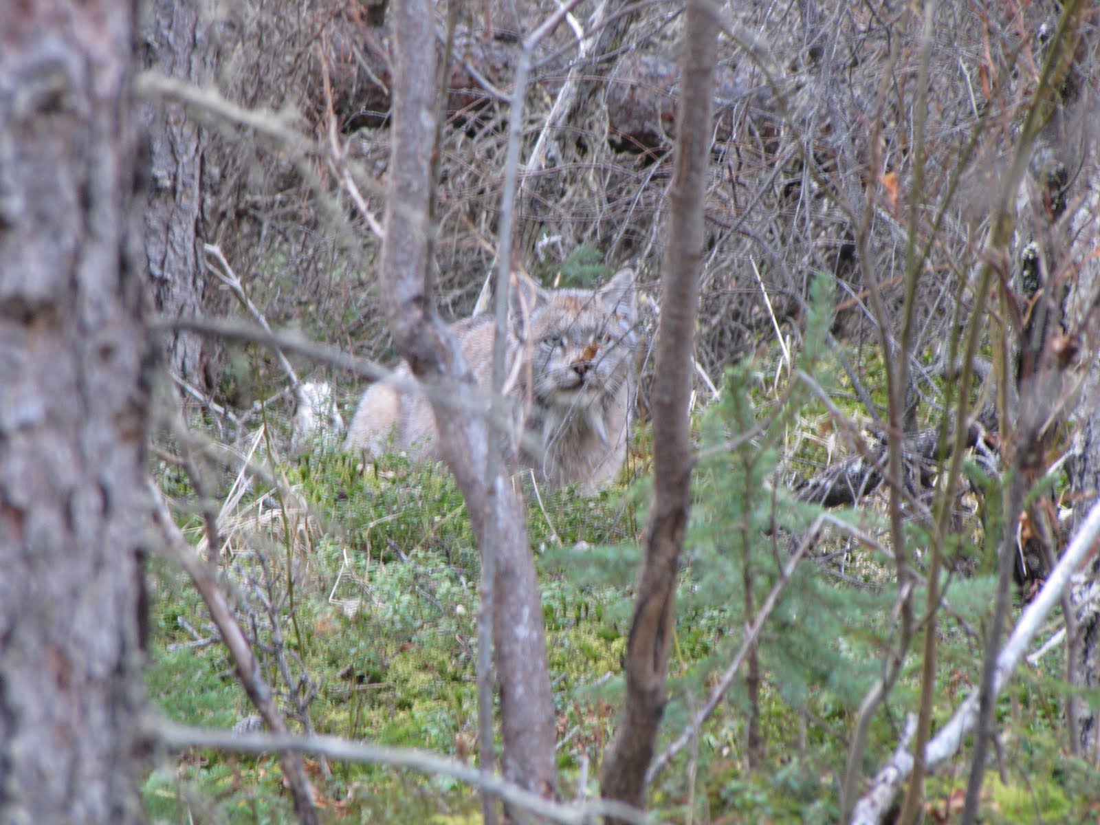
Our day during orientation is from 8:30 a.m. until 5:30 p.m. with a nice hour for lunch. We did a walk-about back to Brooks Falls on Wednesday and then continued on to Lake Brooks, where planes may have to land if there is too strong an east wind such that planes can’t land at Brooks Camp. We soon found ourselves at the turn-off for the road to the Valley of Ten Thousand Smokes and then stopped to visit the lunch shack in the middle of the white spruce forest where the trees have been infested with their own specific beetle and are as dead as the engelmann spruce found on Cedar Mountain in southwest Utah. We stopped to watch as a lynx tried patiently and stealthily but unsuccessfully to make a squawking ground squirrel its dinner. We identified various landmarks that we will use to tell each other where the bears are located during the course of our working day come late June (the point, spit road, lower platform, the bridge, lodge trail, generator trail, beach trail, fish-freezing shack). We have also been given quite a bit of research time to work on our illustrated programs that each of us will give every couple of weeks over the course of the summer.
A few bears are here but thin from their winter hibernation – I have already seen a male, and a sow with a cub on the beach, and then a sub-adult near the oxbow in the river – but the salmon have not yet arrived and won’t start to do so until around mid-June. But they are on their way. As sure as the sun will rise in the morning they have already begun the journey back from the Bering Sea and Pacific Ocean to the glacier-fed rivers of their birth. I have been told that it will take the sockeye salmon 3-5 days to swim upstream from Bristol Bay to Brooks River, a distance of about 64 miles. Meanwhile, until the salmon come, the bears will feed on the grasses. Then one day – BOOM!!! There will be sockeye salmon and bears everywhere. Males will be competing for whatever they think is worth competing for, cubs will be following sows, and sub-adults will be trying to find their way in the world without their mommas.
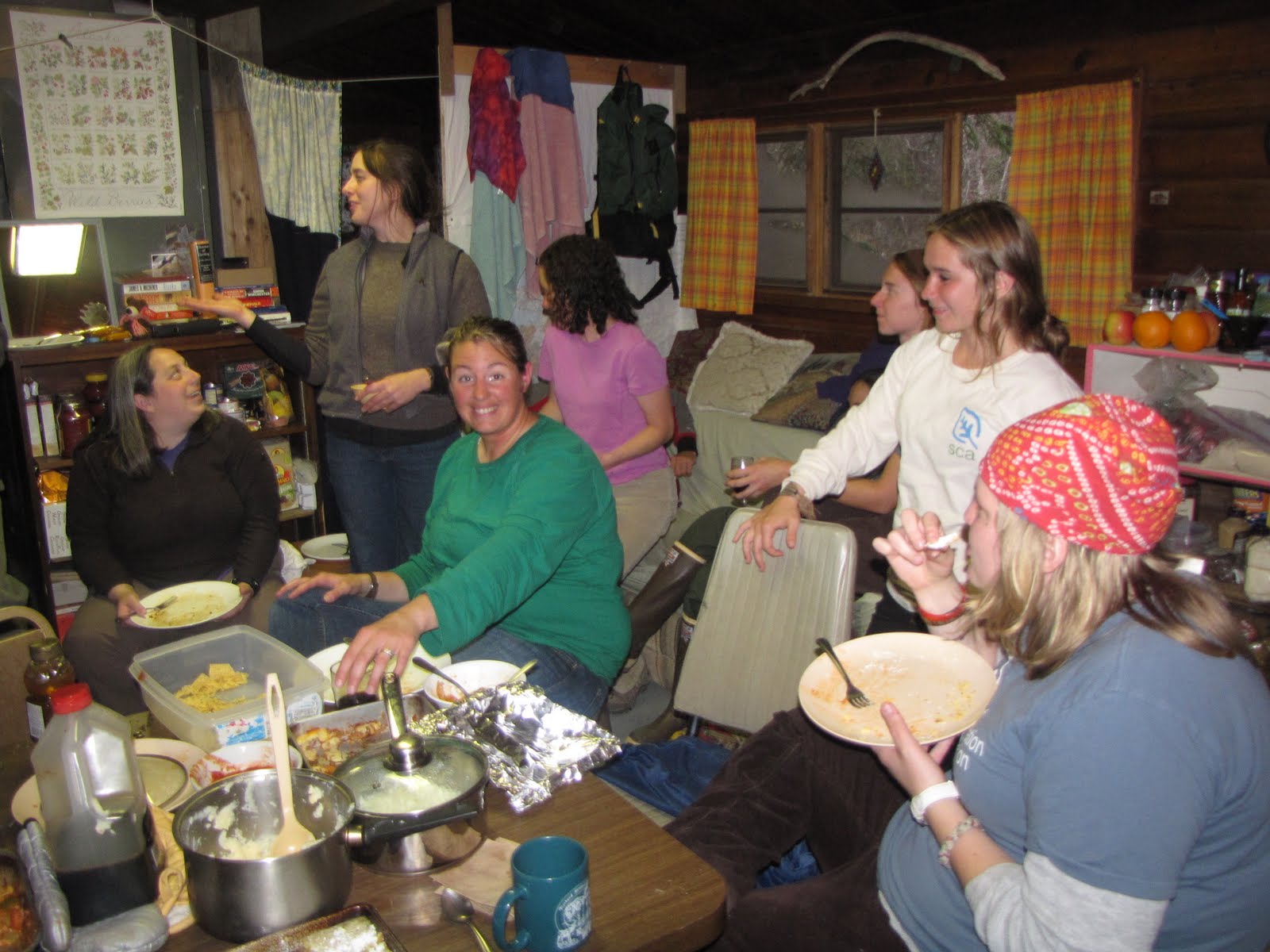
Friday night we held a potluck dinner in our cabin. My cabin mate Christina fixed veggie lasagna and everyone brought a dish. There was everything from sushi to 2 kinds of instant mashed potatoes. I contributed chips and salsa, always a favorite.
Then my Saturday arrived as a cold drizzly later morning, with its doing of laundry, leisurely drinking of coffee, and perusing of the internet to catch up with emails and bills. Around 1:30 in the afternoon I took a hike up Dumpling Mountain for a couple of hours with a few fellow interps. Be forewarned! You will be seeing a lot of pictures this summer from the overlook on Dumpling – it is a mile and a half hike of good exercise, up from Brooks (800 ft elevation gain), through shrubby alder and tall cottonwood to an outcrop of the Talkeetna Formation which is perhaps 200 million years old and with a view at which I can sit and look out at forever.
The rocks of the Talkeetna Fm. were eroded from earlier-formed volcanic island arcs similar to the Aleutian Islands we know today. These eroded rocks were subsequently weathered down and then deposited in their new reincarnation as volcaniclastic (big geology word!) sedimentary rocks. HEY! You have just had a lesson in the rock cycle and you didn’t even flinch.
Did I mention that I noticed 2 bear dens near the trail? WOO HOO!!!
MOVING DAY —
border=”0″ alt=””id=”BLOGGER_PHOTO_ID_5474537515168207682″ />


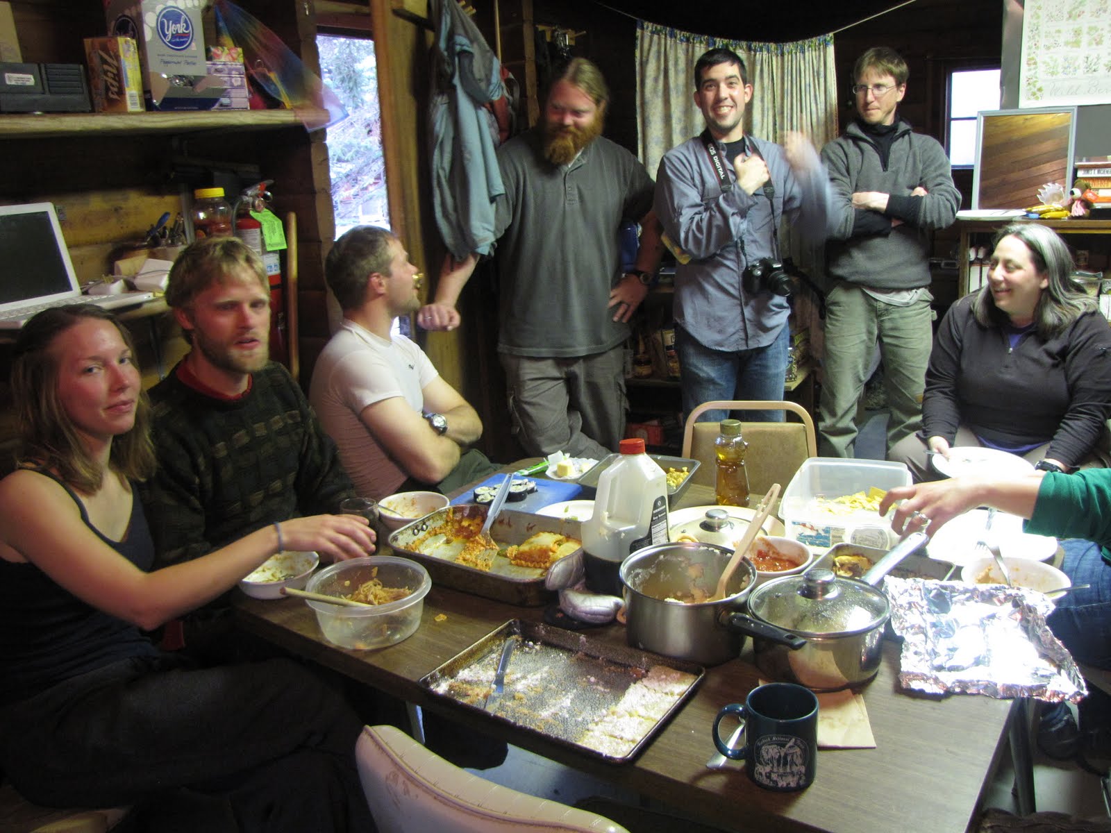
Potluck Dinner
 View From Dumpling Mtn.
 Brown Bear Den
I have arrived at Brooks Camp!!!
And so have the brown bears!!!
I got here Tuesday, 5/18, safe and sound. I do believe that the brown bears were already here, waiting for us and whispering to each other “Oooh, look Yogi. There’s a human. Get your camera! Wow, their paw prints sure are small and they only have 2 of them. How weird is that? Oh well, they will only be here for a few months. Let’s take a walk down the beach.”
Well, enough of this craziness! I love it here. I will have a good posting for you, with some pictures, by this weekend. I am using a dang Mac computer (what IS it with these Mac people, anyway???) and have to figure out where to put my external hard drive and then find out where the file folder is.
Wish me luck! Back in a few days!
Greetings to everyone out there in the WATCH FOR ROCKS traveling blogosphere! I am so glad that you are along to share my journey. Recently I have fielded a couple of requests (YOU KNOW WHO YOU ARE ^_^) concerning the amount of detail in my blog – and I have listened! You want more detail! You want the inside scoop, the nitty-gritty, the down-and-dirty of exactly what I am doing and what I am experiencing here during my summer in bush Alaska.
OK I can do that. I still hope to include lots of pictures too, though. I guess I was operating under the old saw “A picture is worth a thousand words,” and I wasn’t exactly sure how much time you all wanted to devote to reading this literary masterpiece of the blogging genre. More? Less? Well, we’ll see how this new paradigm (big word!) shift goes. I think it will be fun and hope you think so, too! Leave lots of comments! Become a follower!
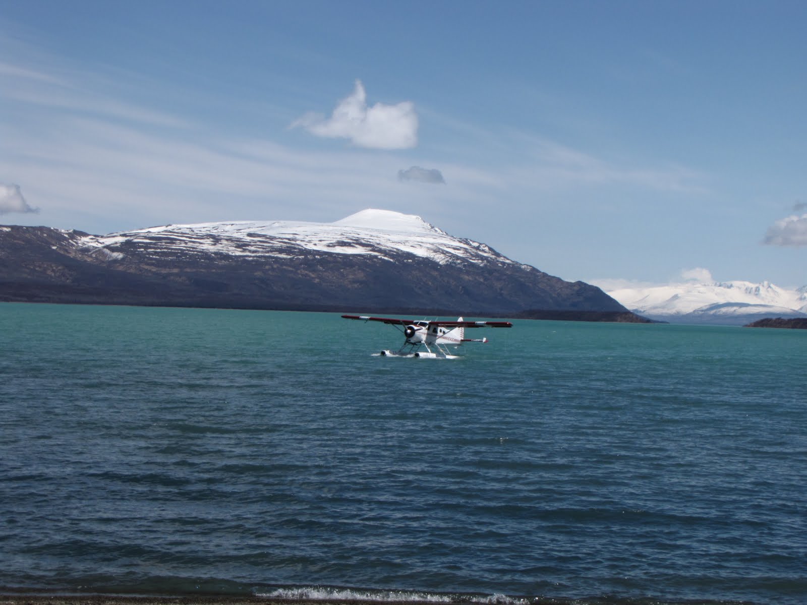
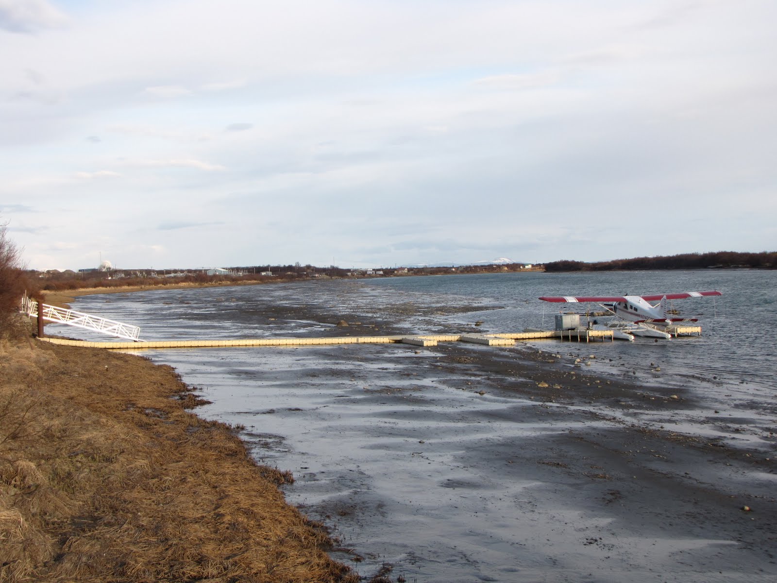
Tonight is most likely my last night in King Salmon, at least for now. Bright and early Tuesday (starting at 7:00 a.m.) we will load up the Park plane and head out to Brooks Camp, a distance of about 22 miles up Naknek Lake. There are a couple of unknowns right now, mainly concerning which plane we actually will end up flying in. There is the Cessna 185, the 4-seater with balloon tires that lands on land (runway, gravel bar, dirt strip, beach, whatever is available). This is the plane I flew in last week on my Katmai Orientation Flight. Then there is the 4-seater DeHavilland Beaver which is a bit larger and is fitted with pontoons for a water landing. If Naknek Lake conditions are good and the water is up we most likely will take the Beaver. It is already at the dock on Naknek River near NPS headquarters. Otherwise we will take the Cessna and land on the beach. In either plane a seat will be removed to accommodate all of our STUFF.
 DeHaviland Beaver
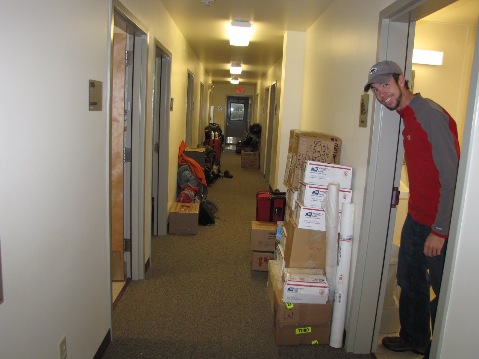
Most of my STUFF has been packed and is sitting in the hallway of the dorm, ready to be loaded into the plane tomorrow. There are just a few things that must wait for the morning to be packed – mostly frozen foods which I will put in my suitcase right before I leave. We all will pitch in and clean our dorm space (bathrooms, kitchen, sleeping area, etc). We also pitch in to load the plane. My roommate and I are on the schedule (tentative and subject to change, of course) to fly out second, around 9:30 a.m. We each are allowed to take up to 5 packages along with us on our trip. Then the pilot will somehow get all the rest of our STUFF out to us. Eventually.
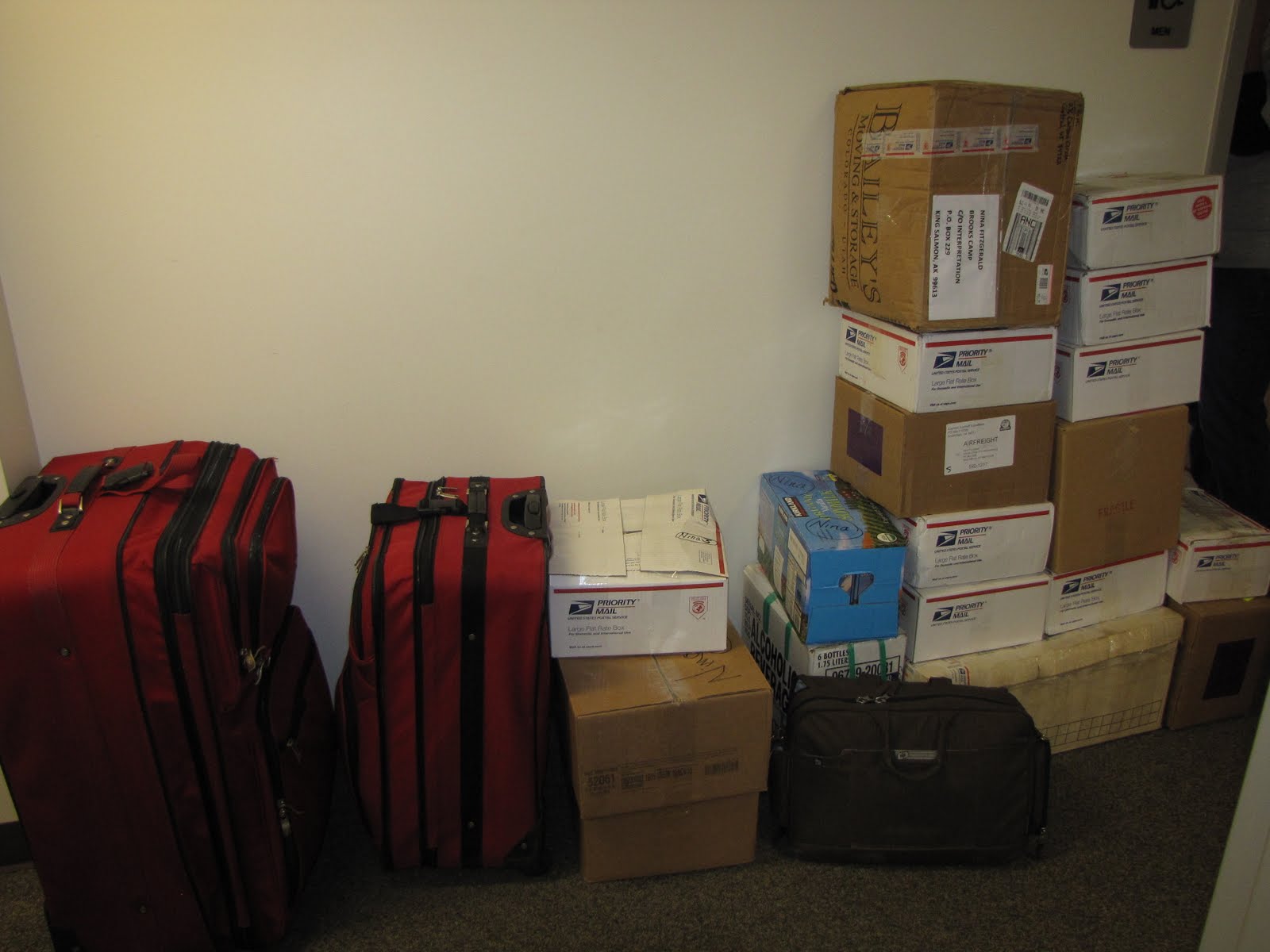
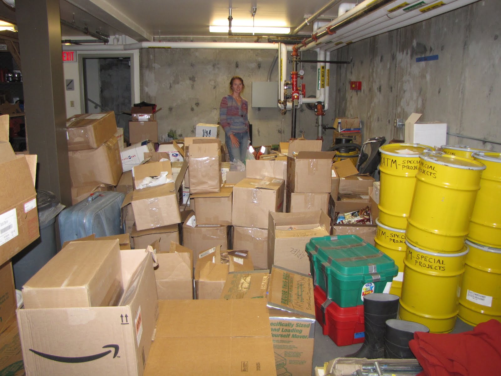 Christina and our STUFF in the basement
So this evening I decided to take myself out for a “farewell to King Salmon” dinner across the street at King Ko Inn and work on the blog. The internet at King Ko was down yesterday and it is down again today (apparently some guest used up all the bandwidth downloading movies) but that’s ok – I generally type my posts in Word (so I have a copy on file) and then copy and paste them into WATCH FOR ROCKS. So when I am done with my cup of seafood chowder, halibut appetizer, and of course 2 beers, I will go over to the Park office and post this. The Park computer did not accept my external hard drive yesterday (which is where I save the pix) and so I couldn’t send any. I have a plan for today, though. I’ll try again on another computer.
I have had a good 2 weeks in King Salmon but am ready to move on to the next part of my adventure in Katmai National Park and Preserve. There are lots more folks showing up in KS, particularly fishery workers since the boats are getting ready to go out. Some of the Katmai staff will work out of King Salmon, some will work in the Katmai backcountry as law enforcement rangers or bear technicians, and still others will come out to Brooks Camp in another week or so and do what they do.
There are a couple of weeks of orientation left for the interpretive staff before the park opens for visitors on 6/1, but this will be done at Brooks Camp. The interpreter’s day-long trip out to the Valley of Ten Thousand Smokes is scheduled for 5/25. I can’t wait!!!
And guess what else – I may be able to have internet access on my laptop at Brooks Camp. WOO HOO!!!
Saturday at last! Finally there is some time to relax and not have to orient myself to anything. Those crazy youngsters were out at King Ko’s last night, playing foosball, shooting pool, and sliding shuffleboard pucks till all hours. I could try to tell these folks about the Longbranch in Knoxville in the 1970’s, or that bar in Nashville where Columbia Archaeological Project digroes spent so much time dancing in the 1980’s… but I won’t. Some things are just too hard to explain. Especially THOSE days!
King Ko has a pretty good digital jukebox (someone was playing “Dixie Chicken” the other evening) and it’s free. The bar stops serving at 2 a.m. but can stay open until 5 a.m. There were some next-morning reports of either 1 bear or 2 in the park service parking lot around 3 a.m. I wondered if the discrepancy in bear numbers had anything to do with the number of beers ingested?
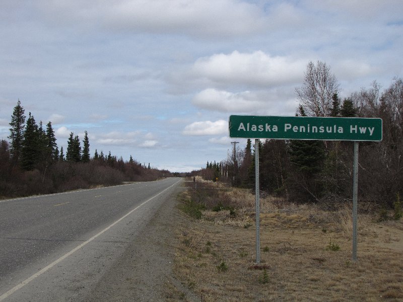
Here are some pix of Naknek taken on our Saturday morning errands-run. Seasonal employees can use the park service vehicle for personal use. We mailed some things at the post office, stopped at a nifty coffee roadhouse owned by a park maintenance person, drove around town a bit, and did some grocery shopping.
The only paved road on the Alaska Peninsula is 15 miles long. It goes from King Salmon to Naknek.
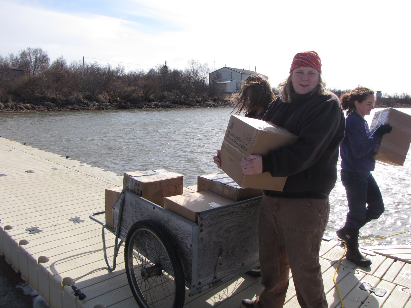
Ariel, Katie, Jeanette, Taylor 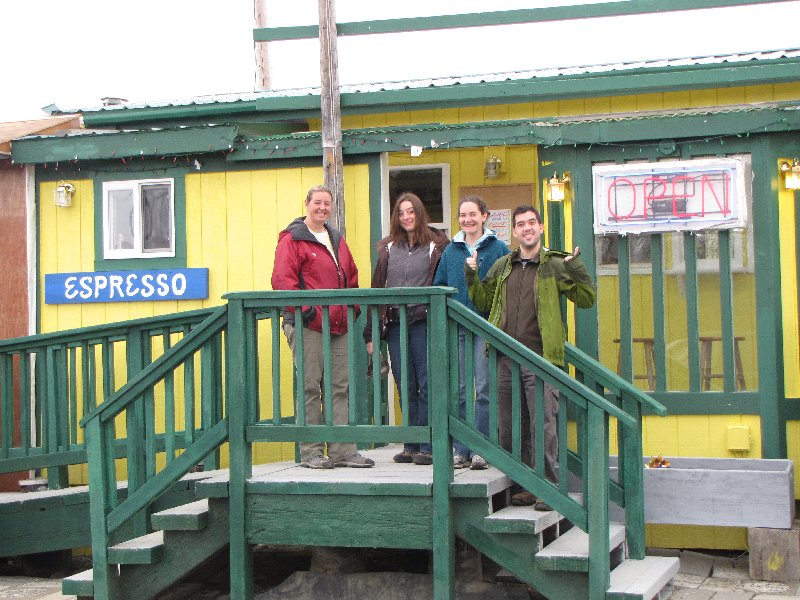
Coffee Shop Dude 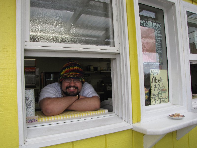
Geo-Traveler 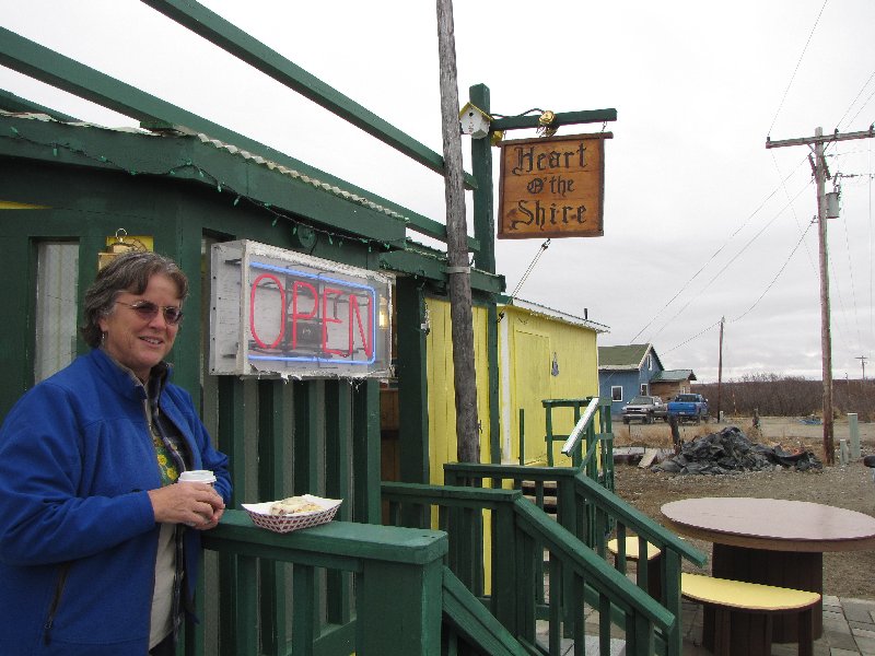
Fishing Boat Waiting For the Salmon 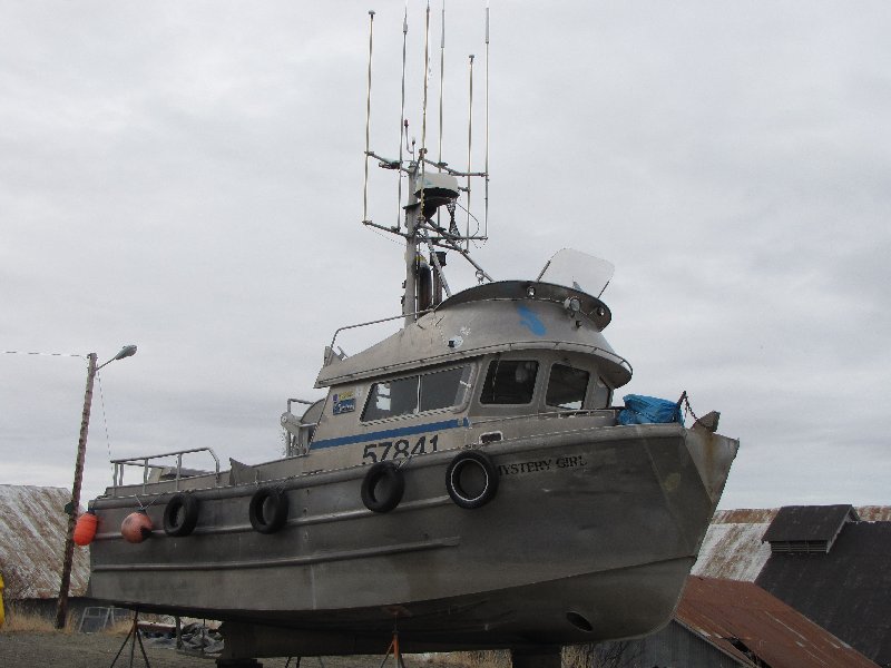
Fishing Boats 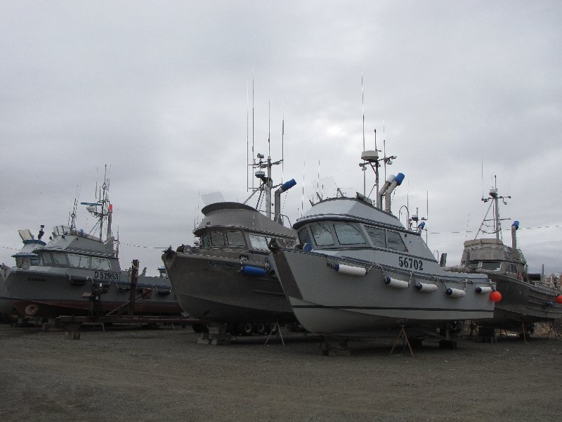
Cannery 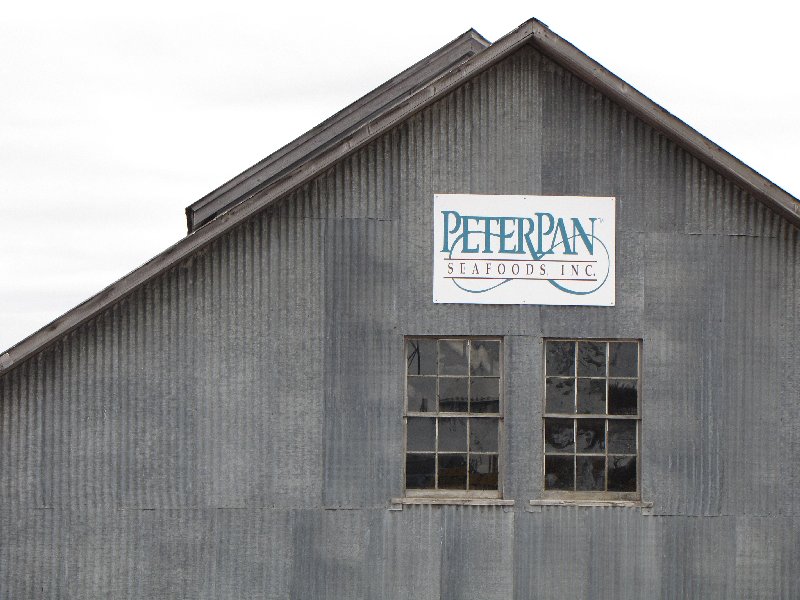
Cannery 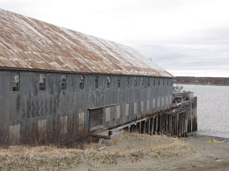
Cannery Housing 
Katie and Taylor, Naknek Beach 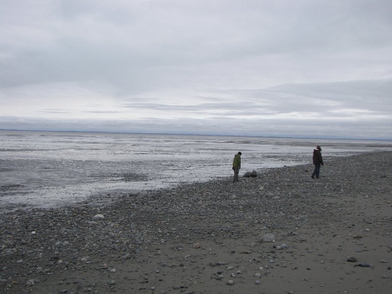
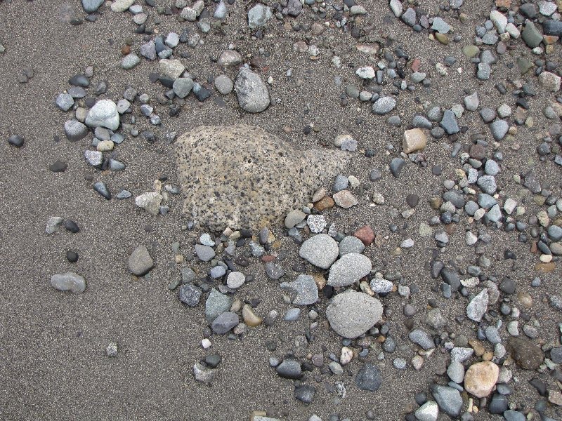
Granitic Evidence of Glaciation on the Alaska Peninsula