After crossing Windy Creek/Three Forks visitor center in distance
After Minnesota Sue and I returned from our Valley adventures, things were pretty quiet. We tried for two days to get on a flight-seeing tour – “If we can’t walk to Novarupta, at least we can fly there!” But once again the weather was the determining factor in what we were able to do, plus the lodge manager was unwilling to bring a plane from King Salmon for only 2 passengers. Since the advertisement for flight-seeing states “minimum 2 passengers” I thought his reasoning to be a bit lame.
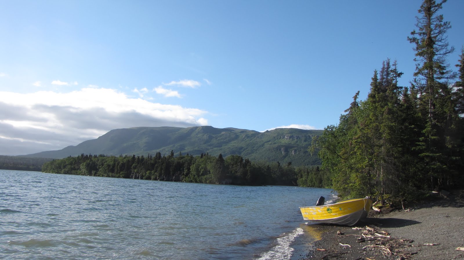
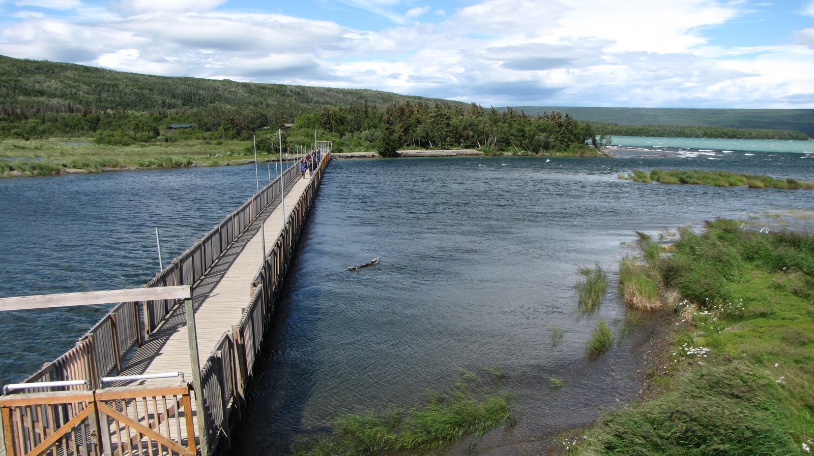
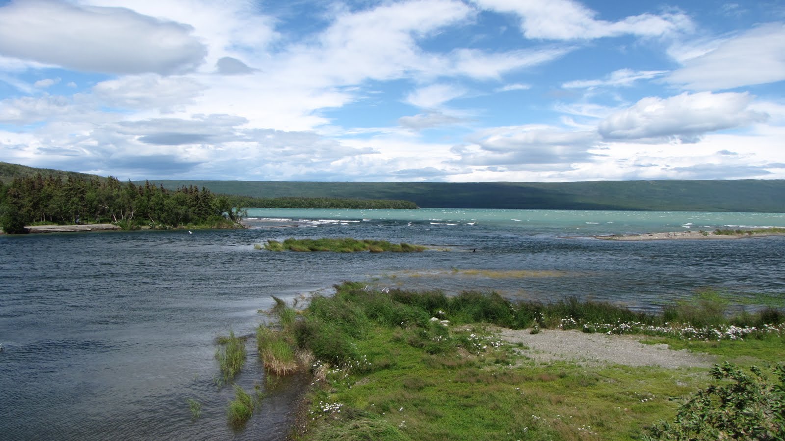
And then I remembered the kayaks. Katmai employees association keeps 2 kayaks at Brooks Camp during the summer for our personal use. I checked to see if anyone had reserved them for Thursday afternoon and no one had. Woo Hoo!!! So we dragged them down to the beach (How much do these things weigh, anyway?) and after sliding into our PFDs and some rearranging of body parts in our respective vessels, we set sail from the visitor center. I have never been in a kayak but I have been canoeing a time or two. I knew which end of the paddle to use (both of them). It was sweet! The water in the lake was nearly glass with the usual insect escort, but then a slight breeze picked up and soon we were rolling over 1/2-inch wavelets. I tended to hug the shoreline (I was not really going anywhere anyway) until I got my sea legs, but Sue was less inclined to do that because there was that big brown bear moseying down the beach and she thought it wanted her for lunch. We toodled over to the mouth of Brooks River and asked Ranger Mike at the corner “Is this the way to Novarupta?” It was a relaxing way to while away a few hours. I didn’t bring my camera because I figured it would end up overboard, entwined about my neck. Sue had hers in the cutest little waterproof camera pouch – that woman sure knows know to accessorize for the Alaska bush!
Later that evening we found our Dutch friends (from the Valley adventure a few days earlier) at the lodge and had quite a nice time drinking and playing cards with them for a few hours until the bar closed. Their names (clockwise around the table) were Robin, Sebastian, Daniel, and Marco. They introduced us to a card game called Toepen in which high card was 10 then descending order of 9- 8- 7- A –K – Q – J with all other cards taken out of the deck. You are dealt 4 cards, player to dealer’s left lays down whatever card they want, and you have to follow suit. You play rounds to 15 points and the person with the fewest points wins the game. I never did figure out the nuances of the game but had a lot of fun trying. Sue and I said goodbye to the Dutch chaps the next day as they headed back to Holland and then we went for a walk to see what the bears were doing.
Sue departed Saturday after I went back to work. I got a postcard from her later in the week, from King Salmon. She almost didn’t make it out of Dodge – flights out of King Salmon seem to be at someone’s whim – but at the last minute was put in first class on Alaska Airlines’ last flight to Anchorage for the season. It was “Just another interesting twist to this trip!”
It’s Sunday morning, a week since Minnesota Sue departed Brooks Camp and my first day off after an eight-day working stretch. And of course it’s raining. It rained all night. The clouds do actually clear once in a while, though. I got to see the full moon the other night, around 10:30. Since Brooks Camp faces east the moon was reflecting a shimmering sliver of silver on Naknek Lake. A planet was rising slowly and brightly just above the horizon and beneath the moon – probably Saturn or Jupiter, since it wasn’t the small red disc of Mars and Mercury would not have been rising that late. Mercury always is seen close to the sun – it will rise early just before sunrise and set just after sunset.
It actually gets dark here at night now on the Alaska Peninsula, unlike earlier in the season when evening would fade to twilight and just seem to pause there for a few hours while I slept. Then around 5 a.m. it would be almost broad daylight again. It never really got dark. We are over 2 months past the summer solstice, and light turns to dark more easily now at this north 58° parallel.
When I was planning the backpack into the Valley with Minnesota Sue, I had hoped we would see at least one night sky full of stars. Earlier in the season it never got dark enough to see the stars very well, and as it turned out Sue and I never got to see any stars at all in the Valley because of the heavy cloud cover the entire time we were out there.
So this brings us back to the melted pants. Sue had laid a pair of hiking pants on a heater that was not supposed to kick on during the night. There are 2 propane tanks outside the building to run the heater as needed, but anytime I have been out to Three Forks there has been no heat nor has the pilot light been on. So I was totally surprised that the heater would even kick on at all.
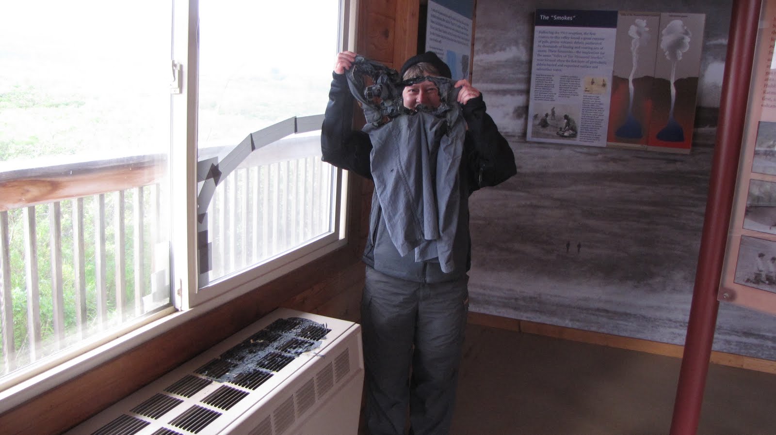
Later that morning the 4 guys from Holland came around, and we showed them the melted pants. They hadn’t been aware of any of our ruckus during the night but only heard the howling winds. We chatted easily about their adventure in the Valley, language differences, the euro and the European Union, and of course geology. One of the fellows thought that perhaps one day there would be one global currency along the lines of the euro. I found it hard to believe that people in the U.S. would ever go for that idea, and he said that it would not happen in our lifetimes but that one day in the future it could be a possibility. It was an interesting perspective from a European.
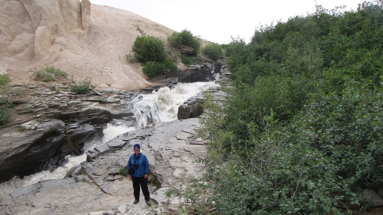
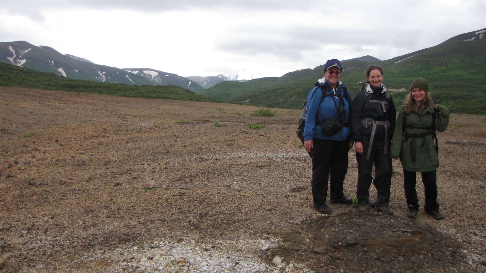
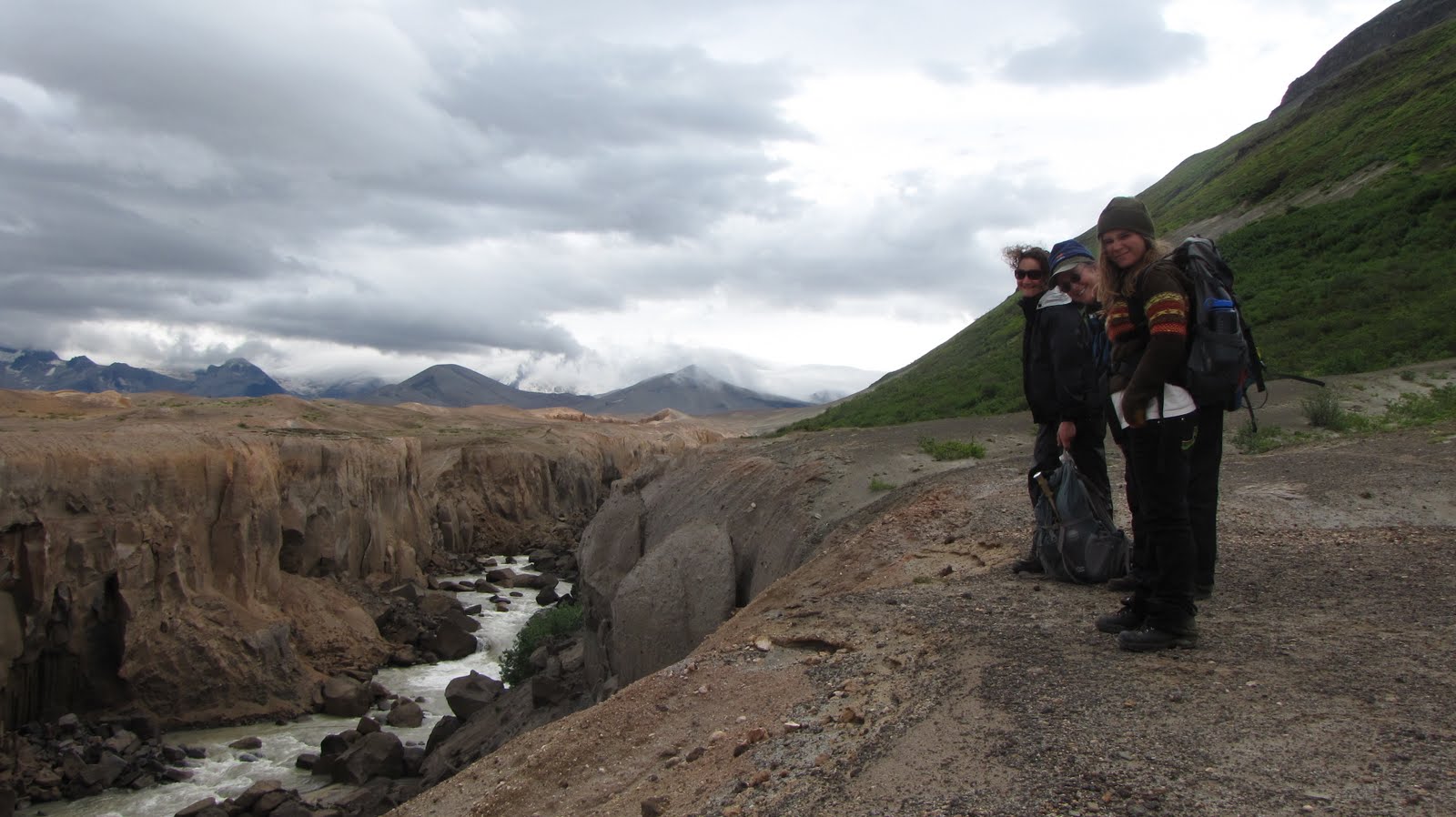
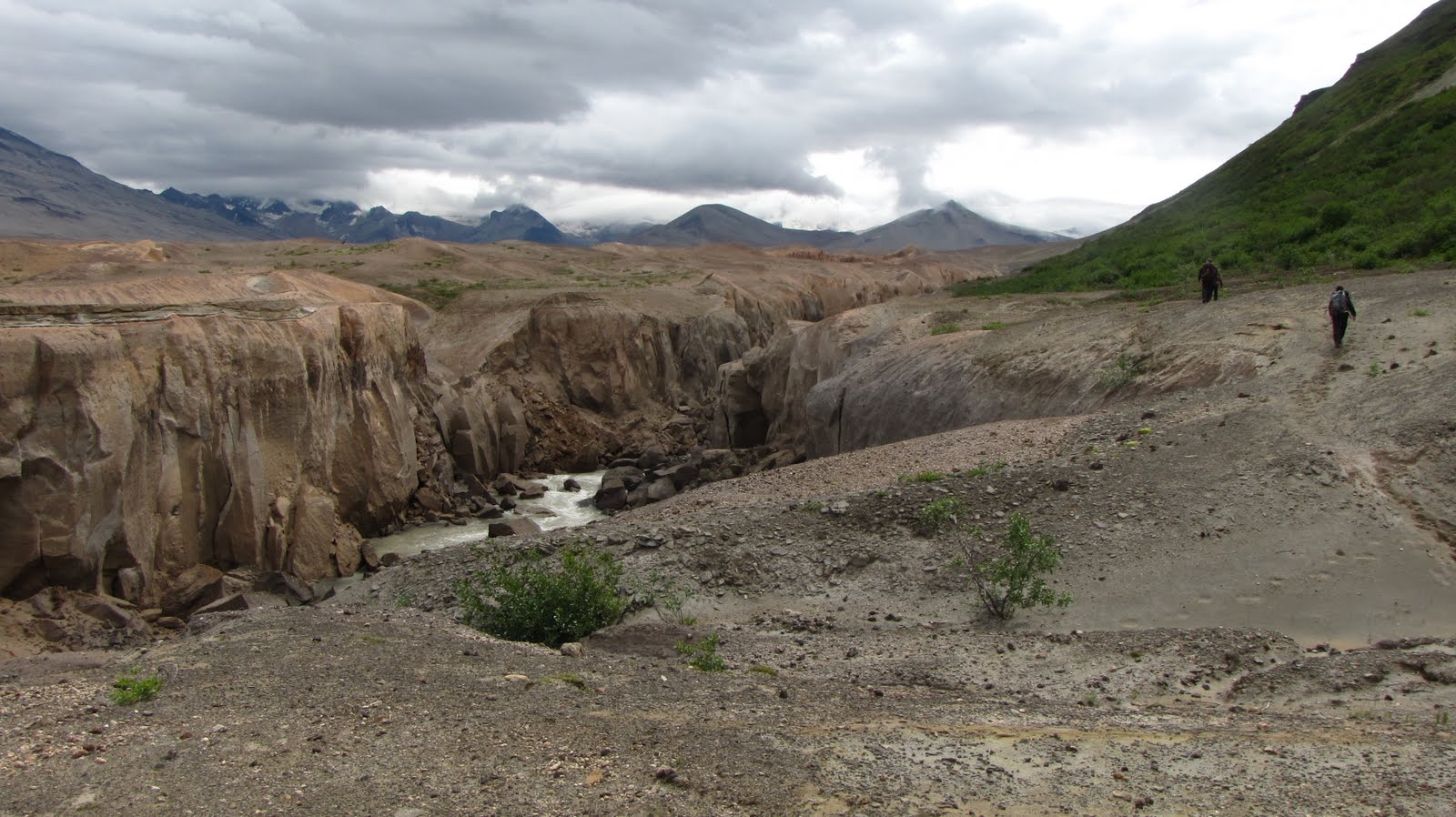
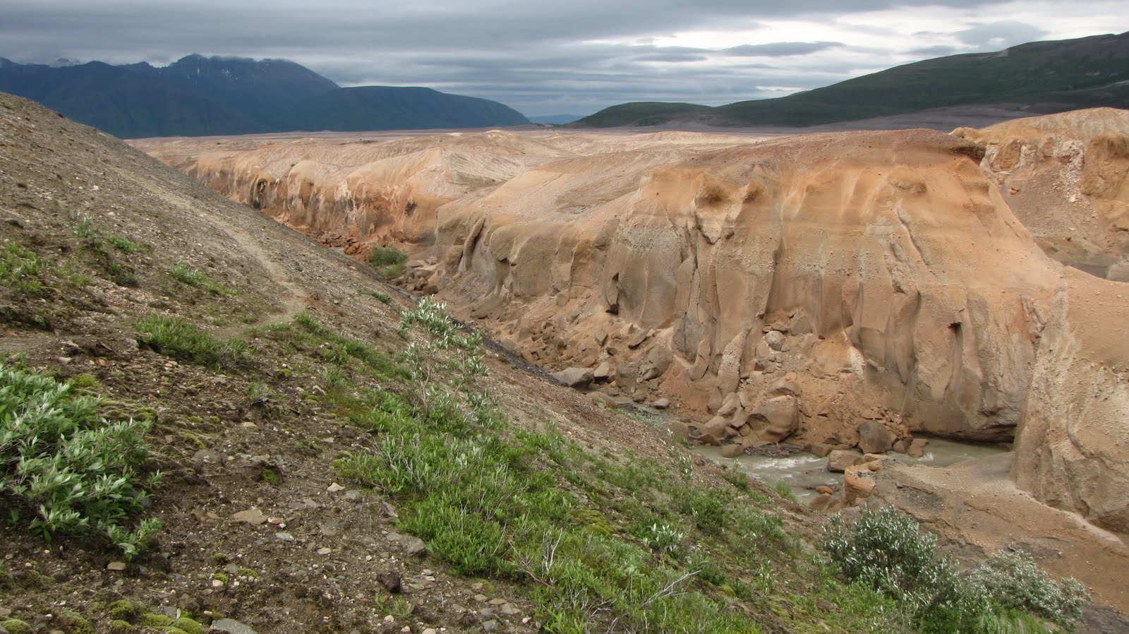
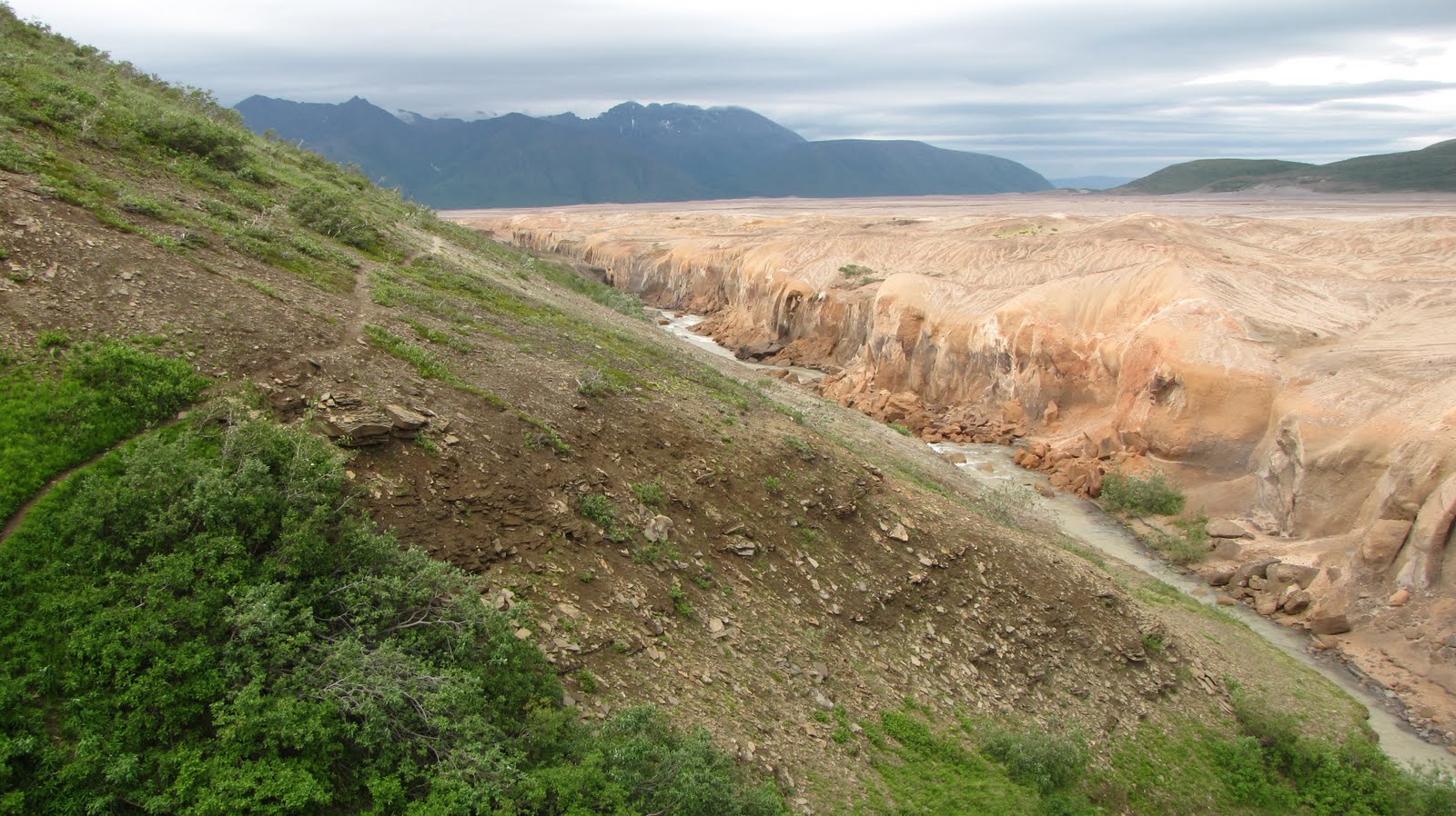
So it was on this overcast morning at the Three Forks visitor center that Sue and I decided on a change of plans. Our comfort level with the weather was marginal and Sue was having trouble with her backpack from the beginning. We just didn’t feel like turning our quest to see Novarupta into a battle with the late summer Alaska elements. So instead we would do 2 day hikes and catch a ride in 2 days back to Brooks Camp. This first day, Tuesday, we would take the trail down to the confluence of Windy Creek/River Lethe/Knife Creek and then Ukak Falls, geologizing to our hearts’ content. Wednesday we would head out the Windy Creek trail into the Valley, geologizing again along the same route we would have backpacked and the same route I did a month or so ago to the 5-mile campsite.
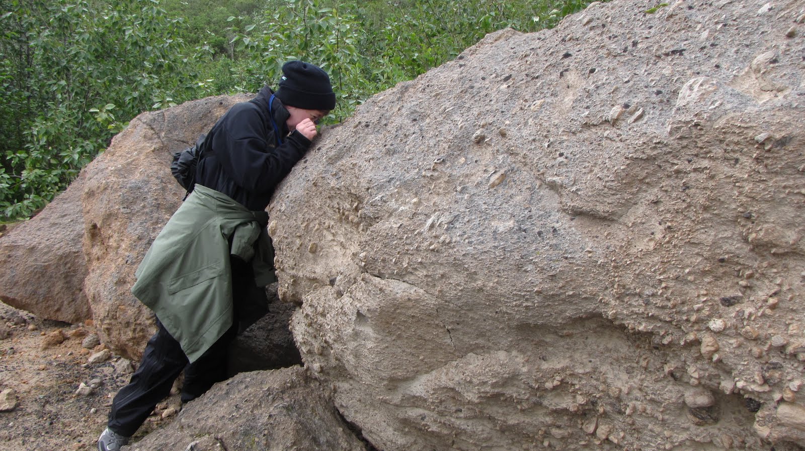
Ukak River and Minnesota Sue on the trail to the confluence
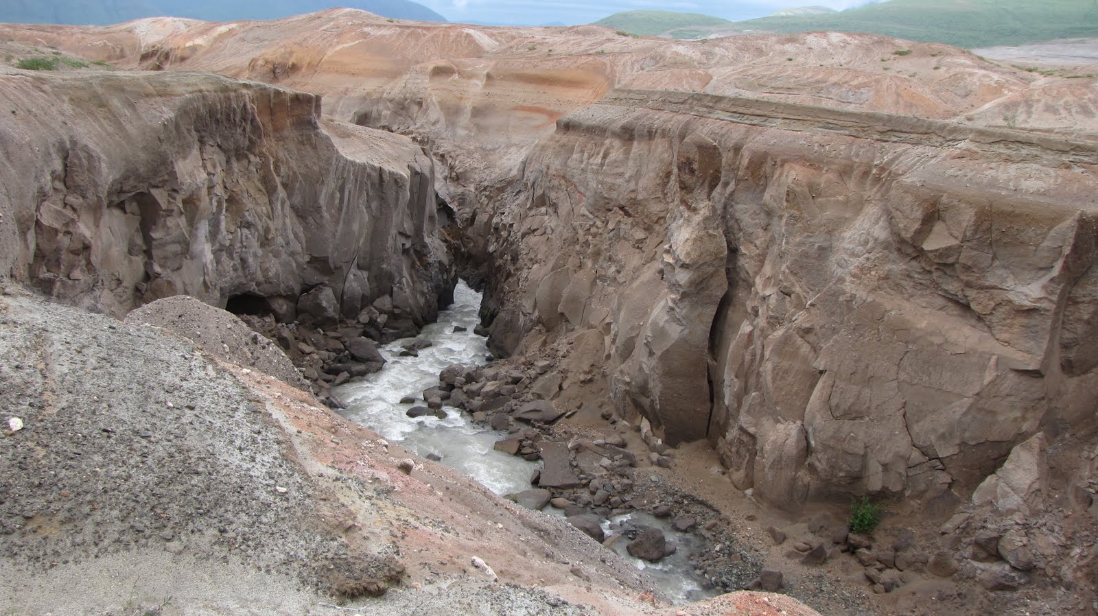
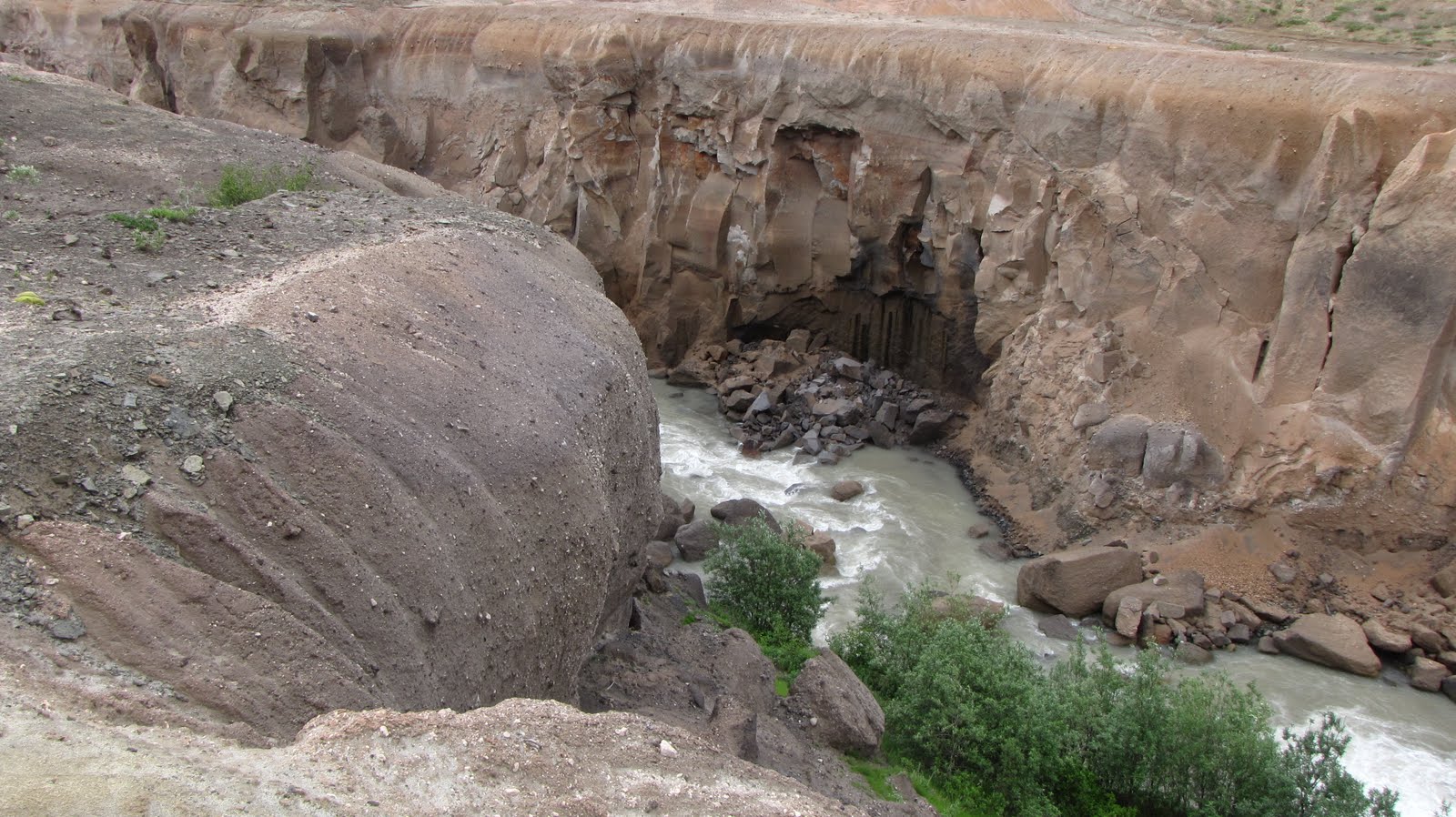
Our early breakfast of Pop-tarts and fruit cocktail didn’t last long, so after an early lunch at 11:00 we headed down the trail to Ukak Falls. This is the same trail that the Valley Tour visitors take except we were able to spend hours longer there, toodling around and stopping at every rock and viewpoint. We discovered paleo-channels in the walls of the ash cliffs, where, between 1912 and now, the rivers coming off the glaciers of the Kejulik Mountains in the Aleutian Range have followed a course and dropped their load of gravels before cutting a new channel through the welded ash that is the Valley of Ten Thousand Smokes. We examined the granites that had been transported down (by gravity and glaciers) from the Aleutian Range batholith (magma that had crystallized underground, forming a massive body of igneous rock which is at least 100 square kilometers in size) – quartz, feldspar, and probably pyroxene were the most obvious minerals we saw with our hand lenses. The ash cliffs have been cut by wind and water into hoodoos, tall spires in spindly shapes that remind many visitors of Bryce Canyon in southwest Utah. We scratched at the lithic tuff – rocks and boulders of welded ash eroded from the cliffs and containing rock fragments and many smaller crystals of mostly feldspar and quartz and pyroxene. In the cliff walls could be seen the fossil fumaroles or steam vents, oxidized remains of minerals in the groundwater that had turned to steam as the 2000° F ash from Novarupta blasted its way down the once lush and green Valley.
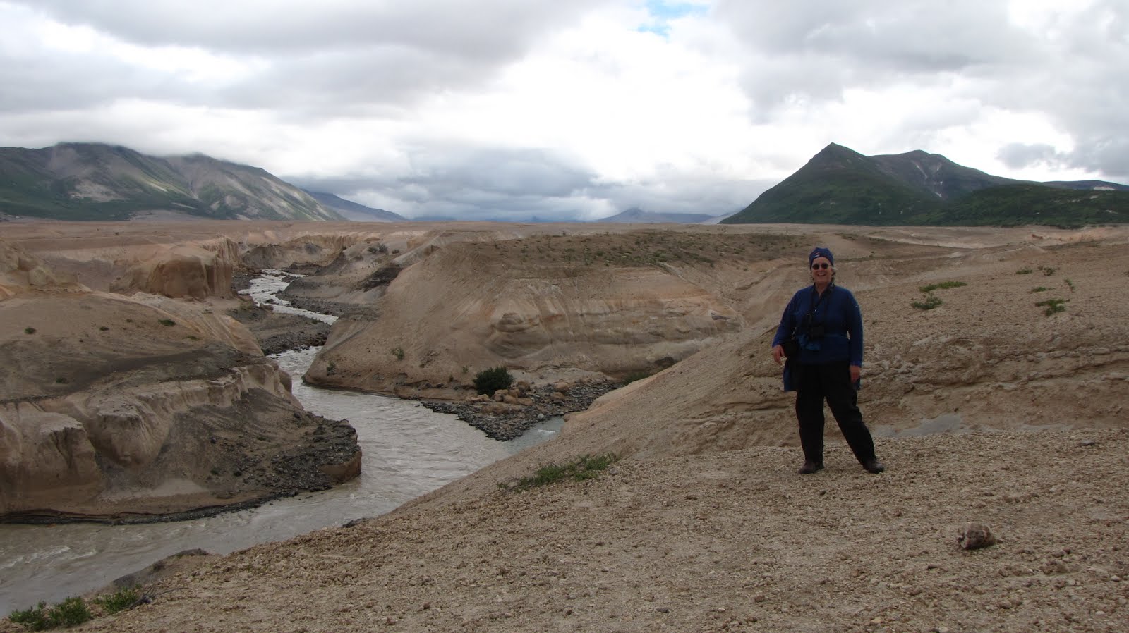
We could see Baked Mountain and (with binoculars) the USGS hut in the distance from the confluence, and I realized that this was most likely as close as I would get to seeing the hut this time around. The mountain stood out white against the dark clouds, like a beacon that seemed to be telling me “Here I am. You know where to find me the next time you try.”
Minnesota Sue examining lithic tuff
Novarupta Nina at the confluence of Windy Creek/River Lethe/Knife Creek
Novarupta Nina at Ukak Falls
That night Sue and I sat on benches at one of the tables in the front room of the visitor center and played rummy as the setting sun broke through the clouds from the west, casting its golden glow on the river-carved canyons of ash far down in the Valley. Ever so slowly the light faded once more and I brought out my candle lantern so we could play a few more hands of cards, nibbling chocolate and sipping the wine that never did find its way into our backpacks.
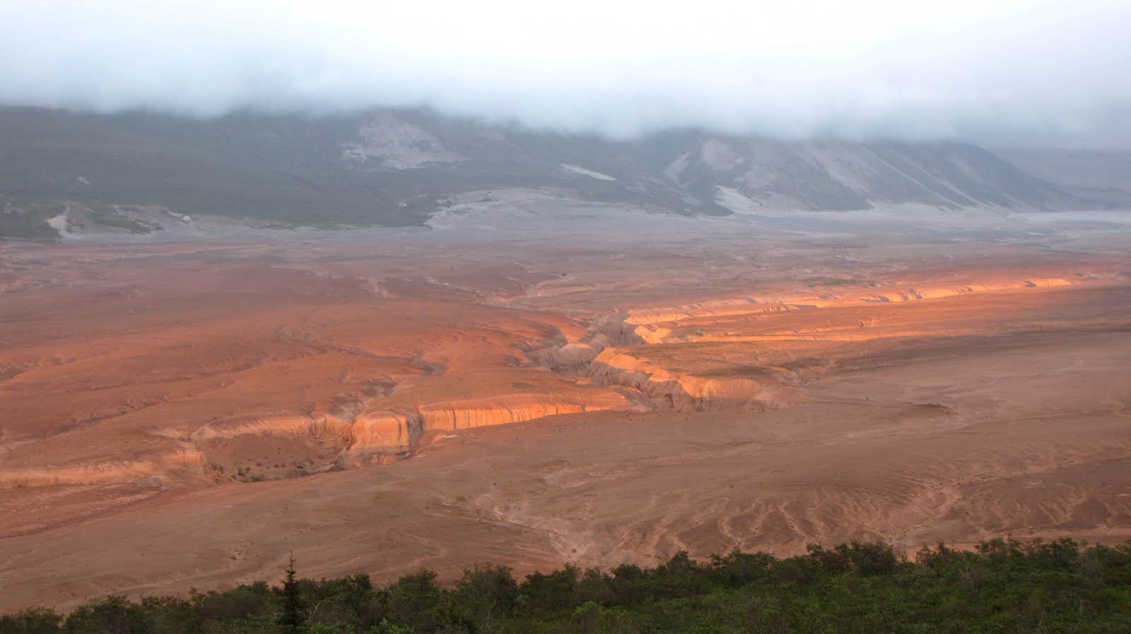
Sunset in the Valley of 10,000 Smokes
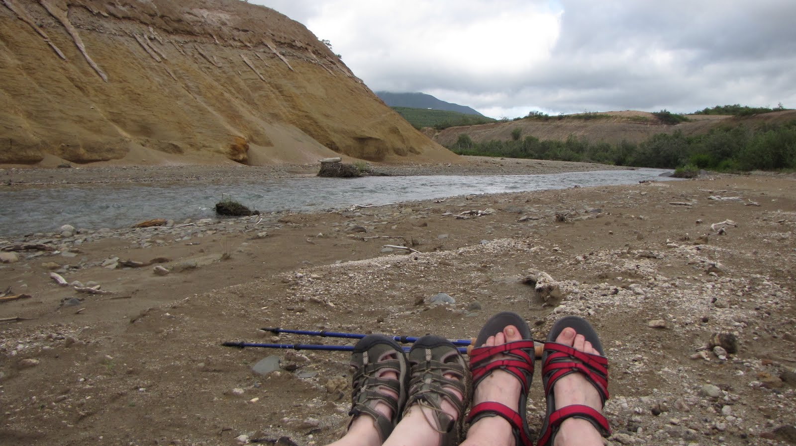
The next morning we set out on the Windy Creek trail, to go as far as time would allow since Kent would be arriving at 7:30 that evening to drive us back to Brooks Camp. Luckily at last it wasn’t raining, there was a light breeze with mostly solid overcast, and best of all there were hardly any mosquitoes or black flies to annoy us. At Windy Creek we exchanged boots for sandals for the crossing and took the all-important ‘feet photo” on the other side as proof we had crossed the knee-deep current. I wished the weather had been more cooperative for us to backpack, but that just put me in mind of the old saying “Wish in one hand…” So again we took what Alaska had to offer us and carried on.
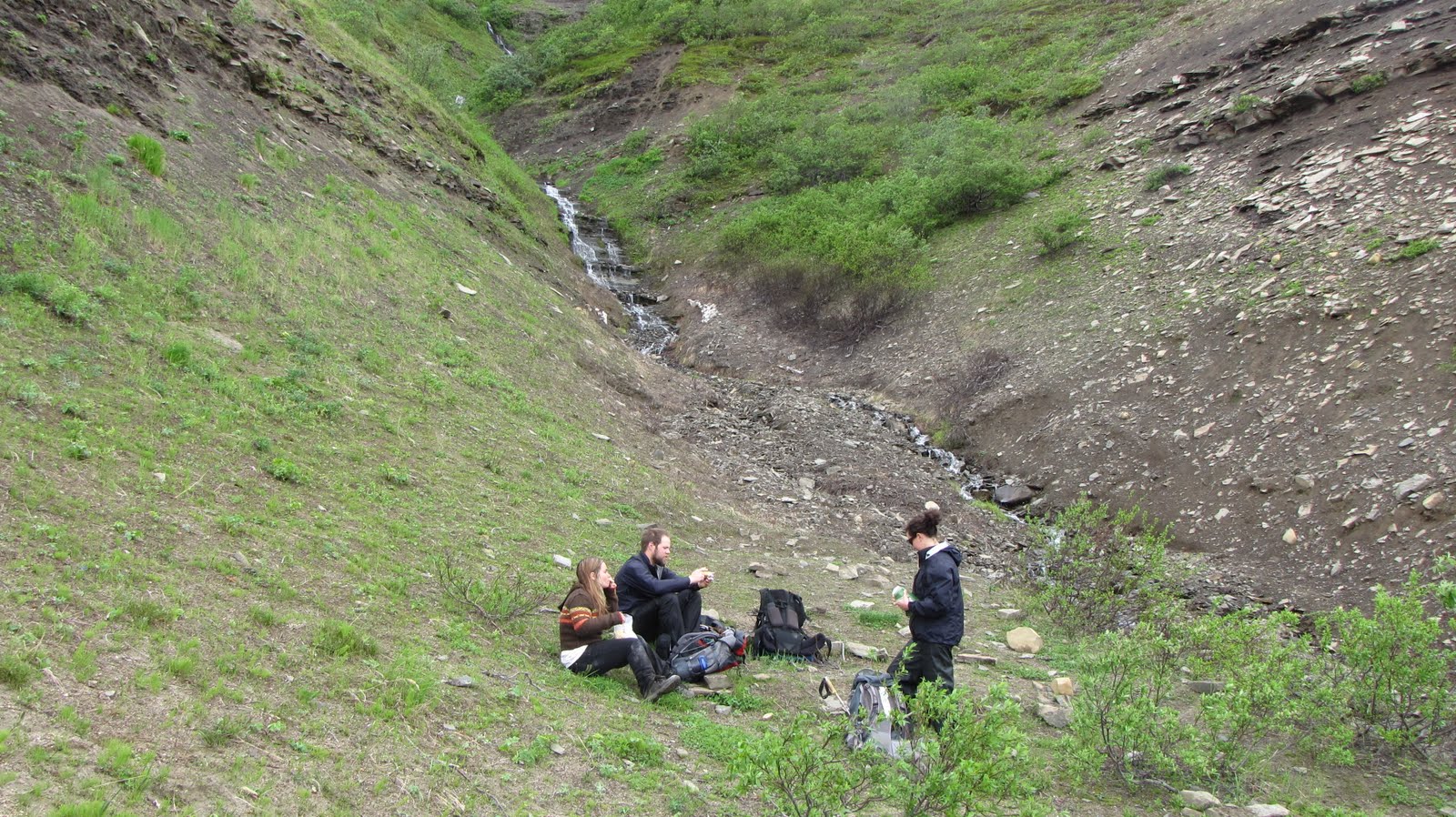
I pointed out fossil fumaroles to Sue, this time not in the ash cliffs but on the ground. We stood around a lone piece of pumice the size of a grapefruit and from the distribution of sediment surrounding it tried to determine the direction of the prevailing winds. We talked about deflation which is the sorting, lifting, and removal of fine-grained particles by the wind and how observing this phenomenon can help determine the wind direction. We checked out much pumice along the trail, of course, and then ate our lunch out of the wind in a dry shallow drainage dropping off the Buttress Range.
We talked a bit as we walked about the disappointment of not reaching Novarupta, about the weather that affected our decision not to go, and how we just didn’t want to turn our days into a battle with the elements. Alaska brings out a heightened need for safety in me. True, we were a little gun-shy, too, remembering the German hiker who had been lost last month and presumed drowned in the Valley. Our days in the Valley were before the NPS plane went down last week. I find it critical to be prepared, both mentally and physically, and if I am going to be hiking in a possible gale-force headwind that can also rip my tent to shreds, I need to be totally ready, to have no doubts about my strengths. So we called it good and live with that. Several people I work with go out to the Valley alone, but I am not one of them. If I come back to Katmai next year I will know more what to expect of Alaska and myself. I know where Novarupta is, and I will know how to get there.
Some of you may already be aware that a float plane with the pilot and 3 Katmai National Park maintenance department employees has been lost since this past Saturday. We are all saddened by this turn of events, particularly in light of the loss due to presumed drowning last month of a German visitor who was hiking with 4 friends in the Valley of 10,000 Smokes. His body has not been recovered from the River Lethe which bisects the Valley. Many of the park rangers had talked with this fellow and his friends over the course of their stay at the park. I had encouraged them to buy the USGS topographic maps of the hike area and not just rely on the less-detailed Trails Illustrated map of Katmai. He and his friends came to my evening program. Alaska senator Ted Stevens also recently died in a plane crash just outside the boundary of Katmai.
Concerning the park employees, I do not know Neal or Mason very well but whenever our paths crossed they were very friendly. Mason always had a friendly hello; his parents were here this summer for a visit. I do not know Neal’s brother nor do I know the pilot of the aircraft. Neal helped me out once with some sketchy tire inflation on the Park vehicle I was about to take out to the Valley. I was told that if there was anyone who could survive a plane going down, it was Neal. He apparently could build a cabin out of twigs and moss and train a moose to help him out. I believe there would have been survival supplies on the plane, but I can’t verify this for certain.
This sad event has given me much to think about in terms of my own readiness in case of some emergency. I joked in my last post about being “overprepared” for our backpack trip into the Valley, but that really only referred to our wanting to take wine and diet coke with us. But what about it? How prepared would I really have been if it were my plane that had gone down? Could I survive? And if I could, for how long? What sort of back-country skills do I possess that would enable me to survive in the Alaskan bush – or even my own backyard of the canyon country of southern Utah?
Would I have really been paying attention when the pilot explained where the fire extinguisher or emergency locator transmitter (ELT) was, and how to operate them? Would I have been paying attention to landmarks on the ground, or just taken it for granted that the pilot knew 100% what he or she was doing? Would I have had any personal survival gear on me, if only some extra food, rain gear, a set of water-proof matches and a flashlight with extra batteries? There apparently are no radio or ELT signals being received from the plane. Were the batteries low? How could we know this if we hadn’t personally checked them?
When we took that “dunker training” during orientation, we were simulating a plane going down in a body of water – I felt afterward that I at least had a fighting chance of surviving an impact, even though the exercise had taken place in the warm waters of the Naknek city pool. My first thought during the training was what to do with my glasses – without them I’d be helpless.
It all makes me realize that I must take responsibility for my own survival more seriously, and not be blasé about letting things slide, thinking they’ll be all right because they always have been – so far. I have come to Alaska for the summer, and my time here has almost come to an end – but how prepared am I, really, for any eventuality?
The search area is vast. It is Alaska, after all. The many people working with Search-And-Rescue are to be commended for their dedication and professionalism. My heart goes out to the families.
Minnesota Sue is now on her way back home via Anchorage with a side trip to Prince William Sound. What a great visit that was! We geologized ourselves nearly into a frenzy for a week while we hiked or lounged about; we salmon-watched and we peered at bears, we kayaked and drank wine and beer and hot chocolate and diet coke and played lots and lots of cards. We lobbed tons of pumice! And we did most of this in the rain, of course. This has been, after all, summer in Alaska.
What we did not do was get to Novarupta.
It wasn’t that we weren’t prepared to go. I would have to say that we were too prepared, if anything. Or perhaps over-prepared would be a better description of our condition. I’m sure you backpackers out there know exactly what I am talking about when I say this.
There was also that bleepingly unpredictable weather.
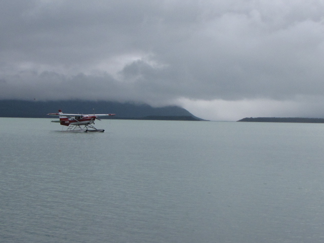
The Sunday afternoon that Minnesota Sue arrived by floatplane (which is a totally cool way to arrive anywhere with a lake) we just took it easy. We moseyed about and I showed her the hot spots at Brooks Camp (my cabin, the Falls, the bar at the lodge), trying somewhat unsuccessfully to orient her to the cardinal directions – but she still insisted that East was North. It was probably best that she hadn’t flown the plane. That night after dinner we attacked our backpacks. Of course, we attacked them accompanied by a large supply of wine nearby. We did pretty much everything accompanied by a large supply of wine nearby.
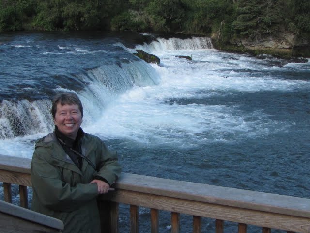
Minnesota Sue at Brooks Falls
Our plan was to pack, then empty everything out and cut it all by half, cut that by half, and cut again, until we got down to a reasonable enough weight that we thought we could carry (“Hey, don’t these things get lighter as you eat the food?” “How many hats does one person really need?”). Well, things got squirrelly when we had to decide between 4 cans of Diet Coke (“One for each day!”) and 5 of those cute little boxes of wine that hold 3 glasses worth each (“We’ll need to celebrate getting out there!”). We almost came to blows. I just didn’t see the need to carry all that carbonated cola beverage. Plus, aren’t grapes an antioxidant which is good for health on the trail? Oh wait – that’s blueberries.
So we jettisoned all the coke and wine and packed only tea and hot chocolate. I still can’t believe it. I am getting sooo old.
But the nightmare of it all was those stupid bear-resistant food containers. Yes, the containers are stupid. And you have to carry your food in one when going into the backcountry in Katmai. But we had two (for reasons that will remain unknown to the rest of the world) and they weigh half-a-ton each (I do not know off-hand what a ton converts to in kilograms, for our metrically-inclined friends).
We went to bed that night secure in the knowledge that our packs were appropriately packed – if we were being transported across Siberia by elephant.
Monday morning dawned. We looked at our packs and groaned. We lifted our packs and really groaned. So we decided to ignore the entire mess and hope it would go away. We went out to lob some pumice and then have breakfast at the lodge where we drank gallons of coffee and diet coke and ate specially-prepared for me (Really! I know the breakfast chef!) bacon-mushroom-swiss cheese quiche and fruit and muffins. Afterward, we went back to my cabin and did the best we could with those packs, but in Alaska, with its unpredictable weather, you have to be prepared for a lot of surprises. How much spare dry clothing do you bring when it rains all the time? We didn’t need to carry much water at first because we could get it along the way – but there is none at the USGS hut so water for nearly 2 days (and how much is that?) ultimately had to be carried for a few miles from the spring. Food? Sue had bought some “backpacker’s dinners” and granola breakfasts, which seemed reasonable enough, but then there was lunch for 4 days, and snacks. You’d think after this many years of trying to get it right about packing the right amount of food and clothing, that I would finally get it right. This time, I just didn’t think of the peanut-butter-and-tortilla combo to last us the 4 days. Plus I like dry socks.
And then there was the tent. Mine is not bad for 2 people – it weighs around 4 pounds (2.2 pounds/Kg for those folks of the metric persuasion). If we thought we were going to get to the hut (10 miles from the Three Forks visitor center) without anything going wrong then we wouldn’t need a tent. But this is Alaska, and something could always go wrong. So you go prepared, and bring a tent.
The sun actually came out for a while
Finally Monday evening we were ready to depart for Three Forks visitor center where we would spend the night and hopefully get a fresh start early in the morning. Kent drove us out along the 23-mile road (we stopped at Margot Falls to check out any salmon there) and soon we were heaving our packs out of the Excursion and into the vc.
Before long we were joined by 4 very friendly youngish travelers from Holland who had been in the Valley the previous night and had a story to tell about gale-force winds coming down the Buttress Range at 1:00 in the morning at the 6-mile campsite where they had pitched their tents. It had been a perfectly lovely evening as they watched the sunset on the mountains and sipped their rum, but in the middle of the night all hell had broken loose and the 50+ mph winds (multiply by 1.6 for kilometers?) and rain raged around and blew down one (or more?) of their tents and snapped some of their tent poles.
I glanced at Sue. This definitely wasn’t good weather news. We chatted a while longer with the 4 very friendly youngish travelers from Holland who had been in the Valley the previous night, and then they went back to sleep in the small room they had come out of earlier. Sue and I stayed up bit longer to play a game of rummy as the light faded from the Valley.
I never do sleep very well on the floor, and so even though I had my brand-new
Big Agnes sleeping pad I had been restlessly dozing. The rain was pounding the metal roof and the wind was blowing like a fiend for the second night in a row – it was a wonder that the roof stayed on the building. I had apparently drifted off, though, and was dreaming of serious doubts about any lengthy hike in my near future, when I heard a loud whisper.
“Hey, Nina!”
“What?”
“Do you smell anything?”
(sniff sniff)
“It smells like toast!”
“What are those guys cooking back there at 2:00 in the morning?”
(rustling about for head lamps)
“Is Novarupta exploding???”
(both get up, stagger around in the dimly-lit darkness, trying not to bump our heads on the interpretive displays and rolling relief map)
“Oh jeez – my pants melted!!!
Stay tuned for Part 2: “NOVARUPTA NINA AND MINNESOTA SUE – THE MUSICAL!”
It’s hard to believe we are halfway through August already. That gives me only five weeks left of my time at Katmai, and soon enough this traveling geo-blogger will be on my way to newer and different adventures.
But wait! I have one more big adventure awaiting, because Minnesota Sue arrived yesterday. We will be backpacking into the Valley of 10,000 Smokes for 3 nights and 4 days. Our meals were assembled last evening (and we will most likely have to whittle down our food selections – How much trail mix can 2 people reasonably expect to eat in that time?) and now we need to figure out how to get it all into the bear-resistant food container that you must carry into the VTTS. Some of that trail mix will need to be jettisoned, no doubt.
Sue had purchased a lot of supplies before she left MN and had mailed them to me. Pop Tarts! You can’t go on a backpack without Pop Tarts. She thought of everything including the all-important thin bagels and swiss cheese to be eaten with little packets of pickle relish and onion from the convenient store stash.
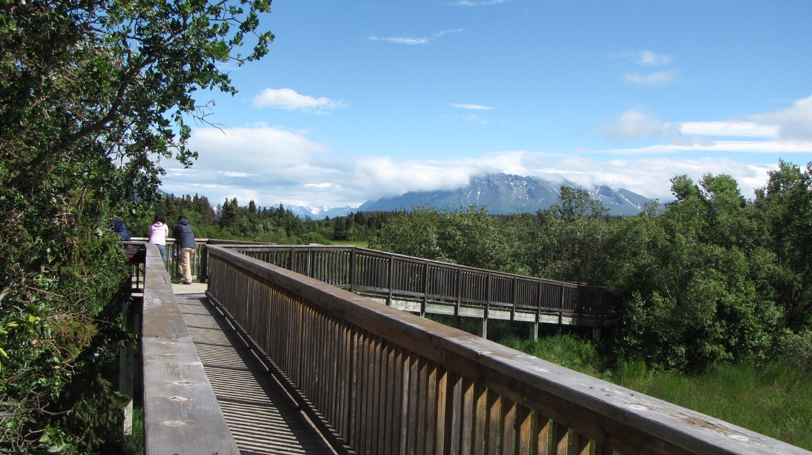
Kent will drop us off this evening at the Three Forks visitor center where Sue and I will spend the night (on the floor again, of course, but now I have a brand-new Big Agnes insulated inflatable sleeping pad, and won’t be using my previously-dreaded I-really-can’t-sleep-on-that-thing closed cell foam pad). The plan is to get up early tomorrow morning and be on the trail by around 8 a.m. in order to get to the USGS research hut on Baked Mountain on our first day out. It’s around 10 miles distance and so very do-able. Then on Wednesday (2nd day) we will explore the area and hike the 2-3 miles to Novarupta and have a look around, and spend our 2nd night at the hut. On Thursday (3rd day) we’ll leave the hut and hike back to the 6-mile campsite below the Buttress Range and spend the night (I am bringing my tent), and then Friday (4th day) we will do the final few miles back to the Three Forks visitor center where we will pick up the Excursion that Kent and Jeanette will have left off (as they start their own 3-day adventure) and drive ourselves back to Brooks Camp.
I will take loads of photos, of course! So I’ll see you when I get back at the end of the week. I’ll have an 8-day work stretch waiting for me when I return, but it will all be so totally worth it.
Sunday morning. Around ten o’clock. The second of my three days off. It’s still cloudy and/or raining. It’s been cloudy and/or raining, like, since when? For-freaking-ever??? Most of July, anyway. This is getting really old.
You should have been here last year, everyone says. Sunshine every day! Seventy degrees every day! Are they trying to make me feel better? I say back to them. This year’s constantly overcast and/or drippy weather isn’t doing my wanna-be-sunburnt-on-my-nose Utah desert rat psyche any good. Everyone also says that this is the rainiest summer they’ve seen in a couple of years.
I really do like it here at Katmai, though. There are still a few bears wandering around Brooks Camp although most have gone to Margot Creek where the salmon are currently running (Great visual there, eh? Are they wearing New Balance?). Visitor visitation is generally down for the month of August since the bears are elsewhere.
Drinking a beer at Brooks Lodge is nice and laid back.
I’m just saying that a little sunshine would be sweet. I’m not used to this kind of wet weather but I definitely like the coolness (desert rat-ness notwithstanding). So today I dug out my bright-pink-palm-tree t-shirt and my equally bright pink fleece hoodie, ready to face the soggy day.  After my noontime lunch at the lodge, I went for a pink walk around camp – the temperature at 2:30 p.m. was 57 degrees with 84% humidity and I expected it could stay that for much of the rest of the afternoon. Then it turned windy, with maybe ½ foot whitecaps on the lake, and just kind of spitting rain. Now the clouds have cleared somewhat and I actually see a spot of blue sky – but how long will it last? I bought a deck of cards at the visitor center – Historically Active Volcanoes of Alaska reference deck from the AK Division of Geological & Geophysical Surveys. I haven’t bought cards in years but I had to have these! Taking them to the VTTS, for sure!
What we need here in southwest Alaska this summer is a little more balance. And a bit more sunshine would go far towards bringing that balance. I haven’t been keeping daily records (not very sharp-eyed of me, is it?) but recently I was perusing some of the pix I’ve taken over the past month (July) and I noticed several days in which the sun actually did shine. YAY!!! But honestly, it didn’t shine all day. Either it rained in the morning and cleared for a few hours later, or it was clear early in the day and clouded up as the day wore on. Either way, I am verging on a serious Vitamin D deficiency if The Sun doesn’t Come Here pretty soon (Where is George Harrison when you need him?). I didn’t even go out on the boat yesterday, to go across the lake to get to Fure’s cabin (Fure doesn’t live there anymore – the cabin is a historic site) and play cards for hours and spend the night on the cold floor, because I am just tired of being cold and wet. I CAN’T TAKE IT ANY LONGER!!! I’M GOING MAD!!! But especially, I don’t want to be sick when Minnesota Sue gets here next week and we begin our (hopefully not soggy) adventure into the VTTS.
A few weeks ago MY FAVORITE TRAVEL AGENT, CAR BATTERY EXPERT, AND SCREEN DOOR REPAIRMAN wrote me about the 113 degree temps in St. George UT and said that the gravel in his front yard was melting. Coincidentally, at the very same time he was complaining about – oopsie, I mean writing about – this, I was standing on the lower river observation platform in the rain while wearing every single piece of outerwear I had bought or brought with me. Besides my regular uniform of pants and shirt and water-proof shoes and socks, I also had on rain pants, a sweater, fleece jacket, a gore-tex parka with the hood up, a ball cap, beanie, and 2 pairs of gloves. 
When all else fails, wear bright colors and let those voices in your head channel George H. while singing out “Here Comes The Sun!”
And always have a deck of cards handy in case of rain.


I was the first person to wake up the morning we were supposed to hike out for our overnighter in the Valley. Of course it had rained all night, and was still raining. Should we have expected anything else? It was nowhere near a pounding thunderstorm (never raining hard enough, for instance, to choke a toad), but was just an Alaskan rain – a soft, light, steady drizzle through low gray clouds that obscured the surrounding mountain peaks. The diffuseness of the light kind of made my head ache and I thought “Oh jeez – I don’t want to start out hiking in this weather.”
Starting a hike in the rain can be a real downer. My personal philosophy regarding this phenomenon is that starting a hike in sunshine is much better for morale. If the weather deteriorates from there, well, at least there was some sunshine to be had for a while. But if the hike starts in the rain, is seems certain that for some reason it will stay raining forever. I’m just saying.
So we procrastinated for as long as possible (“We could stay here and play cards all day…”). I was not the only one with less than the highest amount of enthusiasm for setting out in the rain. But we finally got motivated. We had to get motivated – the Valley tour bus was due any moment and we had to vacate the visitor center by the time they arrived. OK! Everything goes into the back room as quickly as possible! Pick up the sleeping bags and stove and water bottles, sweep the floor and wipe the tables and they will never know we had been there!
So we had barely gotten our stuff moved when the bus drove past the window. Oooh, busted!!! OK – decision time – we’d go hiking for the day to the 5-mile camp site and back. We’d hike down the low mountain from the visitor center into the 98-year-old Novarupta ash flow where there would be one river crossing across Windy Creek, and then the walking would be easy, around the base of the Buttress Range for a while and along River Lethe. There was a good enough trail – yay!!! A trail in Alaska!!! My dreams have come true at last. And we’d be able to catch a ride back to Brooks Camp that evening.
Coming down off the mountain the trail passed through some serious foliage and mucky tundra. The trail was easy enough to follow, though, and there were long views into the misty cloud-shrouded Valley. I wondered how hammered I would be at the end of the hike (I was totally hammered) and how miserably tired I would be climbing up out of the Valley after 11 miles (I was definitely tired but nowhere near miserable) if it was still raining (it most certainly was raining). There was a narrow run-off stream to jump before crossing Windy Creek, and then a quick climb up the river bank put us on our way into the Valley proper. Woo Hoo!!!
At the fumaroles
Pumice from the 1912 Novarupta explosion was everywhere on the Valley floor – rhyolitic, andesitic, and banded pumice in every conceivable combination. Gray-black and rusty orange discolorations in the ground were evidence of the fumaroles or “steam plumes” that had occurred in the floor of the Valley – the ash flow was thought to have been at temperatures of up to 2000 degrees F, searing the lush green Valley and turning groundwater into steam which curled upwards in columns of 500 feet or more (Robert Griggs, in a 1916 expedition to the Valley, thought there was a huge magma chamber beneath the Valley and that the steam plumes were “emanations” from this subterranean magma). The fumaroles had ceased their steaming activity by the 1930’s.
River Lethe and the Three Amigas
Hiking along River Lethe
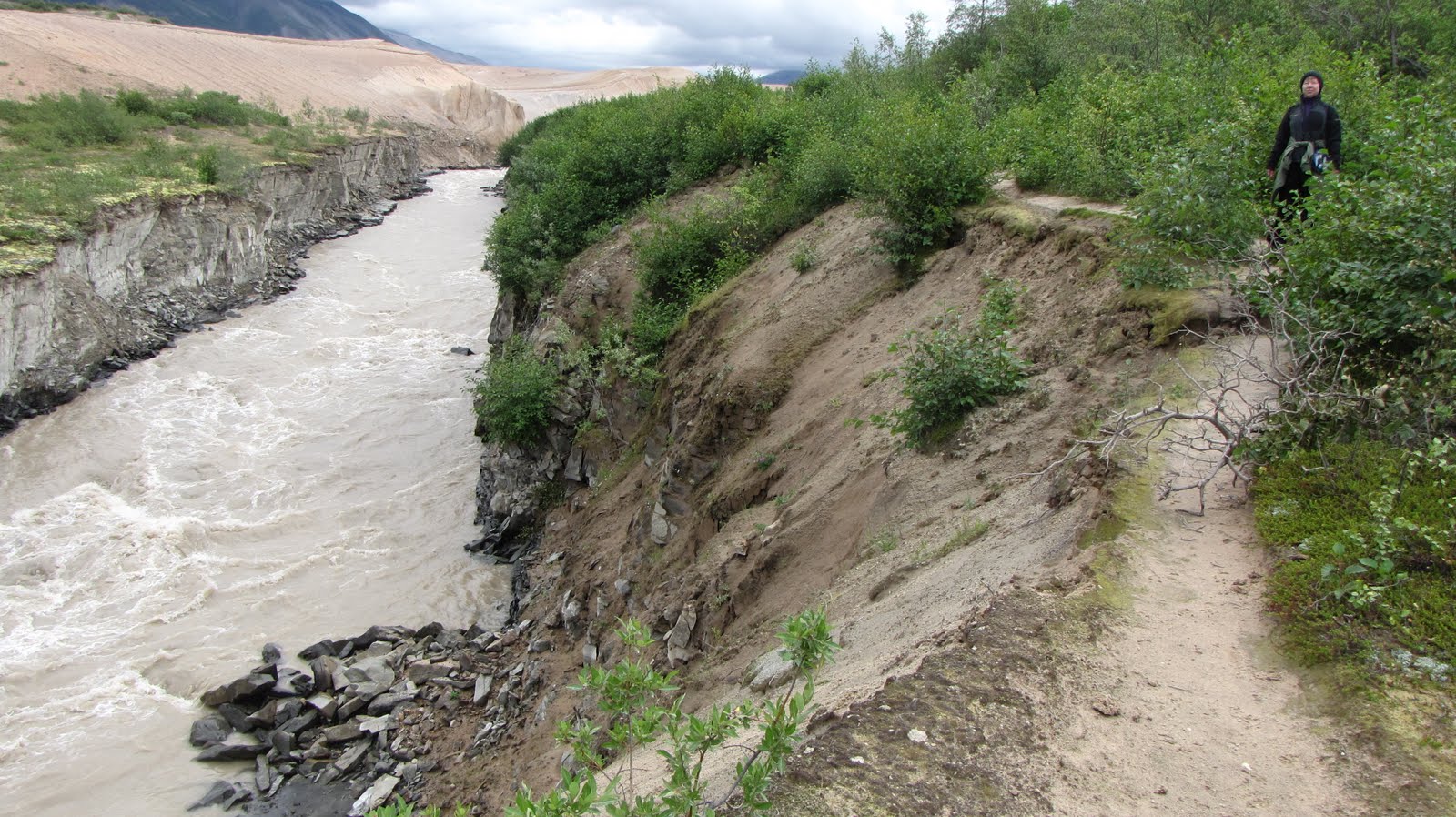
The trail wound toward and then along the base of the Buttress Range and soon we were walking beside the deep, narrow canyon that the River Lethe is relentlessly cutting through the ash. Blocks of ash from the nearly 100-foot canyon walls are eroding away as the river winds this way and that, eventually working its way down to bedrock and some semblance of its original pre-eruption course, on its way to the Savonoski River and eventually out to the Bering Sea.
Lunch spot
Views from lunch spot
Lunch was at the 5-mile campsite beneath a cascade of clear water dropping from high off the Buttress Range (I filled my water bottle and drank from it, and a week later I am fine so I guess there was little enough bear, beaver, or moose poop present to cause me grief). We enjoyed lovely warming sunshine for about 30 minutes while we ate and from then on the misty drizzly rain continued as our intermittent companion for the rest of the hike. The Young Hikers wanted to go on further and explore, but this old girl explained that my total hiking distance would end up being 11 miles by the time we returned to the visitor center (5 mile campsite was actually 5 and ½ miles according to Steve’s gps) and so, familiar as I am with my personal limits, I would be starting back. Jeanette was gracious enough to go back with me while Steve and Jacqui would explore and catch up with us later.
Have you ever noticed how the hike back usually seems shorter than the hike out? Jeanette and I even took our time and stopped for some photo ops. Before I knew it we were tracking away from River Lethe and pointing our boots across the flat ash terrain toward the crossing at Windy Creek. Here we temporarily replaced our boots once again with sandals and, using our poles as support, forded the thigh-deep swiftly-moving creek. We sat in the wet sand to put our boots back on (we were wearing rain pants – we could sit anywhere!) and then continued on our way, up the low, thickly vegetated, seriously rain-drenched mountain and back to the visitor center.
I was soaked to the bone, totally chilled, and really, really tired.
But the Valley is worth it and I can’t wait to get out there again.
Canyon of River Lethe