Yellowstone National Park is totally amazing and I am extraordinarily lucky to be here. It’s not everyone who gets to live, work, and recreate inside one of the world’s largest active volcanoes. I have come to the conclusion that if this supervolcano decides to blow while I am here this summer, I am definitely good with that. It can take me with it wherever it goes.
As I write this on Monday, Memorial Day eve, it has been snowing since last Thursday and we are adrift in a late spring winter wonderland of northwestern Wyoming. I am stationed at Grant Village and will be interested to find out what this place looks like when the snow finally melts – in August, perhaps? We are at 7770’ above sea level, at an area of Yellowstone Lake called the West Thumb. A smaller caldera inside the larger caldera, West Thumb exploded around 174,000 years ago, 466,000 years after the last supervolcano explosion of some 640,000 years ago.
My two week training period is over. I have been at work for two days already, staffing the visitor center, roving geyser basin trails, and working on any of seven programs I will be presenting over the summer. I will present programs primarily about the geology but also have an interest in North America’s largest rodent. Women in the early park service might also be one of my topics. We are renaissance rangers, to be sure.
I am definitely good with it all.

I almost didn’t go on the backpack last weekend, and was surprised to hear that most everyone else had considered backing out, too. We all had our excuses, most of them pretty flimsy. But one thing we all soon agreed upon was that we sure were glad we hadn’t bailed. What a shame it would have been if we had missed it all.
The first day out dawned gray and dreary with a chance of snow or rain. I mostly didn’t want to run the risk of getting sick from staying out overnight in the cold – the first week of training for Yellowstone’s seasonal interpretive park rangers had just ended and we had another week to go. And there were the bears, of course. I knew that any midnight snuffling sound outside my tent would be enough to send me into spasms of terror. I would have to sleep (ha! like that would ever happen) with one eye open, clutching my bear spray canister in a white-knuckle grip of death, all the while hoping I wouldn’t asphyxiate myself with fear.
As it turned out, all we had to deal with were a couple of errant bison and a suspiciously inquisitive Canada goose.
Around noon we started out on the Black Tail Trail, just east of Mammoth Hot Springs in the northern part of Yellowstone. We would be going just four sweet miles to a campsite along the Yellowstone River. Prepared to do the tent thing if necessary, we all hoped that, come sunset, we would be comfortably settled in a warm Park patrol cabin and not miserably huddled on the cold, cruel ground.
") |
| Black Tail Trail, Yellowstone National Park |
") |
| Black Tail Trail |
Park rangers are a wonderfully peculiar bunch. They stop to examine and talk about nearly everything they see, and in Yellowstone, that everything is everywhere.
Hundreds of bison were migrating to a greening summer valley…
 |
| “Look! Bison!” |
BisonMigratingIn YellowstoneNP") |
| Bison on the move |
 |
| Bison migration |
Elk pieces-parts were scattered about…
 |
| Elk skull with antlers |
 |
| Arrow-leaf balsamroot |
Wildflowers bloomed in early high-country spring…
 |
| Larkspur |
 |
| Shooting star |
 |
| Basalt outcrop |
And, of course, the rocks tumbled down…
 |
| Columnar basalt cliffs high on the ridge |
By the time we arrived at the cabin by the river it was three hours later and the bison were long gone. We dropped our packs to explore the nearby surroundings and then relaxed after our grueling afternoon hike.


I was excited to see glistening boulders of metamorphic rocks lying along the banks of the river, pinpoints of maroon garnets reflecting in the light. My geologic map of Yellowstone National Park shows that these are indeed Precambrian gneisses and schists but does not offer any more information about them. I understood I was standing in the Archean Wyoming Province, where the rocks can be older than 2.5 billion years, and I was thrilled. This is primordial rock, ages beyond even the 1.74 billion year old metamorphic rocks of the Beaver Dam Mountains in southwestern Utah.
 |
|
| Schist boulders in river |
 |
| Phyllite? Or just wet schist? |
 |
| Schist boulder |
 |
| Bridge across Yellowstone River |
 |
| Sun setting on Yellowstone River |
As dusk slowly descended along the river, no one else except the goose came to claim their night at the cabin. It was to be all ours, after all.


The next morning we left the cabin cleaner than we had found it and headed up the warm, sunny trail on our four mile return hike. Past the cliffs of columnar basalt and the elk skull and out into the wide valley, I paused to look back.
 |
| Black Tail Trail |
On the east side of the continental divide, Black Tail Creek carves its path through a fault in these ancient rocks. I considered how this creek was on the way to its own destiny as it drains into the Yellowstone, Missouri, and Mississippi Rivers and ultimately the Gulf of Mexico.
What a shame it would have been if I had missed it all.


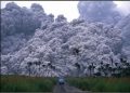
") It’s been barely one week since I arrived at Yellowstone, and the days have passed like the rushing water of spring snowmelt thundering down the surrounding mountains. There is still a lot of snow in parts of “the interior,” as the Yellowstone Plateau is sometimes called around here. The roadways are clear but drifts remain that were pushed up by the plow. Beyond the road, dense lodgepole pine forests are still covered in a thinning blanket of white. But in other places in the park, the snow is all but disappeared and the rocks of Yellowstone are once again laid bare.
It’s been barely one week since I arrived at Yellowstone, and the days have passed like the rushing water of spring snowmelt thundering down the surrounding mountains. There is still a lot of snow in parts of “the interior,” as the Yellowstone Plateau is sometimes called around here. The roadways are clear but drifts remain that were pushed up by the plow. Beyond the road, dense lodgepole pine forests are still covered in a thinning blanket of white. But in other places in the park, the snow is all but disappeared and the rocks of Yellowstone are once again laid bare.
The park’s wildlife is arriving right on time, to graze on the newly sprouted grasses and feast on the carcasses of whatever did not make it through the winter. “Animal jams” are becoming common, too. However, instead of a bear jam or a bison jam, last Sunday I had my very own Uinta ground squirrel jam.
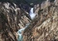
Shaggy bison meander down the middle of the park road, one brown eyeball staring at car window height as they unhurriedly leave us behind. Grizzly bears dash across a meadow or graze at the forest edge. On our first day in the park we used a spotting scope to identify a wolf, a black shadow making its way across snow-covered Hayden Valley about a half mile distant. In addition, I have seen martens slinking across downed logs, a porcupine lumbering into the underbrush, white pelicans landing gracefully on the swiftly-moving Yellowstone River, golden eagles soaring overhead, great blue herons standing tall, and Barrow’s goldeneye bobbing along with the current.

The day before I started work I took a drive. I wanted, of course, to see Old Faithful and the Upper Geyser Basin of which is it a part.

The new visitor center has excellent interpretive displays about the caldera, one of the world’s largest active volcanoes right beneath our feet. The geyser trails were clear of snow and the sky was a brilliant blue.
")

I’m just starting to figure out the hydrothermal features and the three things needed for them to exist – heat, water, and a plumbing system. I am learning what types of organisms, called thermophiles, live in the differing temperatures of the hot springs, and that in the geysers of Yellowstone, water boils at 199°F.
")


The view on the way back to Grant Village and the West Thumb Geyser Basin was the perfect afternoon ending. It is already starting out to be an excellent summer!


Highway 26 in eastern Idaho passes through soaring plateau country where I felt like I could reach out and touch the mountains peaks. At Swan Valley I crossed the sinuous Snake River once again before turning onto highway 31, and then climbed steeply to Pine Creek Pass at an elevation of 6764 ft above sea level.

Soon the road dropped down into Teton Valley and Victor, ID. Like shingles overlapping one another on a westward-sloping roof, the mountains to the east of Victor look to be the result of compression and contraction of Earth’s crust during the Sevier orogeny, a period of mountain building that occurred from roughly 150 to 55 million years ago. This overthrust belt is a segment of an immensely twisting trend of folds and thrust faults extending along the western edge of the continent from Alaska to Mexico.
Highway31Near VictorID")
Highway31Near VictorID")
Grand Teton is visible in the distance on the left, a distinctive ragged, jagged peak jutting skyward on the eastern side of the thrust-faulted mountains. Separating the high mountains and valleys of western Wyoming from the lowland volcanics of the Snake River Plain, the Tetons present themselves as a breath-taking wall of rock.
My overloaded mini-tank of a Subaru wheezed up Teton Pass (elevation 8431 ft) in third gear, passing a utilities truck like it was standing still. Oh, wait – the truck was standing still. At the Pass, Jackson Hole came into view.
ViewFrom TetonPass")

The east flank of the Tetons is much different than the west. Unlike the compressional or thrust faults present on the west side of the range, the east flank is bounded by a gigantic normal fault which has raised the Teton Range and dropped Jackson Hole. As mentioned in a recent post, the Teton fault is the easternmost normal fault separating the Great Basin and Rocky Mountains. Additionally, the crustal extension and thinning caused by normal faulting occurred millions of years later than the thrust faulting seen on the west side of the range. The Tetons are a result of geologic processes pulling apart the crust in an east-west direction. These processes continue today.
SnakeRiverAnd TetonRange JacksonWY")
 A break in slope occurs where the steep mountains meet the valley floor, and this occurs with dramatic elegance at the eastern base of the Teton Range. Here we witness the trace of the Teton Fault. The fault can be seen along the highway north from Jackson, easily identified by the steep slopes or fault scarps showing up as darker areas at the base of the mountains.
And so I continued north towards Yellowstone…
Grand TetonNP")
Grand TetonNP")

I couldn’t stop stopping to take pictures…

Frozen Jackson Lake…


The rear view was clear the entire way…
I knew I would find it!

My main reference was: Lageson, D.R. and Spearing, D.R., 1991, Roadside Geology of Wyoming, revised 2nd edition.
For a quick check on Sevier-age thrust faults near Victor ID, I found this information and much more in: Lageson and others, Neogene-Quaternary Tectonics and Volcanism of Southern Jackson
Hole, Wyoming and Southeastern Idaho, online at http://imnh.isu.edu/digitalatlas/geo/gsa/papers/gsac2p7.pdf accessed 5/15/2011.
About 30 miles north of Pocatello, Idaho, I-15 crosses the eastern edge of the broad, arc-shaped Snake River Plain and the tip of one of its voluminous lava fields. This little bit of interstately geologic heaven is known as Hells Half Acre. It is particularly noteworthy to me in light of the fact that I was on my way to Yellowstone National Park, situated as it is on top of undoubtedly the most famous magmatic hot spot on the planet. What is intriguing about Hell’s Half Acre is that it sits smack on the track of the Yellowstone hot spot.
HellsHalfAcre Interpretive Trail")
HellsHalfAcre Interpretive Trail")
Massive volcanic activity has occurred in the Snake River Plain starting about 17 million years ago in the present Nevada-Idaho-Oregon border area. This activity is believed to have been caused by the Yellowstone hot spot. Volcanic features extend along the arc of the plain from this border area all the way to Yellowstone, many becoming younger towards the east. The Snake River Plain tracks this volcanic activity as the North American plate moves in a southwesterly direction at a rate of about an inch per year.
Track the hot spot here. This is so cool!
Further east along US highway 26 the Snake River drops down from the mountains of western Wyoming and into eastern Idaho. Here, it cuts a winding westerly swath through different layers of volcanic rock that do not track along the Snake River/Yellowstone hot spot path.

SnakeRiver")
SnakeRiver")