We are refreshed, rested, and re–invigorated after a spectacular day of lollygagging on Big Mountain in the wilds of northwestern Montana. The morning of our fourth day on the road we again partake of another ginormous KOA breakfast. Then JC, CO, and I wave a final adios to Whitefish, Montana and eagerly turn our two–car caravan northward once more.
A few miles later on US highway 93 we are drawing closer to our ultimate destination. I am so wound up I can hardly keep my foot on the clutch.
Thanksgiving 2011 has come and gone, and I’m slightly aghast that it has been nearly a week since I’ve posted anything on WATCH FOR ROCKS and even longer (here, here, here and even here) since I wrote about my adventures getting to Canada. With nary a turkey giblet in sight during my favorite holiday I kept myself busy gobbling grilled swordfish and blackened mahi–mahi along with some of the best gumbo this side of the Atlantic. There were also several slices of key lime pie involved in this feasting. No wonder I was distracted.
In the previous few posts (I’m nothing if not accommodating – check them out here and here and here) we’ve been cruising a 2005 memory highway, making our way north from southern Utah to the Canadian Rockies. The conclusion of day two on–the–road finds us comfortably camped for a couple of days at a KOA just south of the international border near Whitefish, Montana. That blurry morning–after picnic table photo tells the tale of our 14 hour, 700 mile, pedal–to– the–metal marathon.
More adventures await! But first… Before taking this northern exposure any further, whether it be up Big Mountain, near the headwaters of the Columbia River, through the Rocky Mountain Trench, or onward to the big bad Burgess Shale, I have an announcement.
Seven hundred miles in fourteen hours, all in one day. Our two–car caravan just keeps on driving and driving and driving. I’m still reeling from that sweet road marathon and it happened six and a half years ago.
After taking in the sights of the unconformably implausible Indian Riding the Dinosaur display north of Twin Falls, it is time to hit the road. There is major Idaho real estate to motor across and we are burning daylight. We will in due course stay on US93 for hundreds and hundreds of twisting mountainous and straighter valley miles, through central Idaho and western Montana all the way to the Canadian border. Interestingly, beyond the border this highway retains the number 93 if not the same country as it courses itself into and up through our neighbor to the north.
There’s nothing like starting a story at the end to pique people’s interest, eh? But now I am in a bit of a dilemma. Should I go back to the beginning of my two adventures in Canada, starting in August 2005, and relate events in the chronological sequence as they occurred? Or should I just plop down somewhere in the middle of the story and go off willy–nilly as the mood strikes?
After a couple days of searching I have finally located the box within the box that holds the disc containing the photos of those early traveling days. Now it is easier to put things into some semblance resembling a chronological order. Looking back at our hundreds of digital images, it is easy to remember the current of excitement the three of us felt. For six months our anticipation surrounding the trip had built and by the time we left southern Utah we were all about to explode. JC and CO and I were finally on our way to see the 515 million year old fossils of the Burgess Shale in Yoho National Park high in the Canadian Rockies. Not many people I know (with the exception of any envious geologist I happened to tell) are even aware of what or where the Burgess Shale is. Even fewer had been to see it. But we had booked ourselves on hikes to both the Walcott Quarry and the Mt. Stephen fossil beds along with a week’s lodging in the tiny burg of Field, BC. Extraordinary geologic fun was our primary agenda!
Four days seemed a reasonable amount of time to drive 1400 miles – this would give us plenty of opportunities to see some sights along the way. On this first adventure (for there would ultimately be two) we left home in early August 2005 and quickly burned some rubber along interstates 15 and then 84, cruising first up through Utah and then on a westerly stretch in southern Idaho. We turned north at Twin Falls and looked forward to the less hectic pace of secondary roads. Soon a shady roadside picnic area beckoned and we just knew we had to stop.
In layers of rocks on the ground there can often be found an unconformity, a substantial break or gap in the geologic record where one rock layer is overlain by another that is not next in the stratigraphic sequence. For some reason there would have been a change in the deposition scenario of these rocks, a hiatus, an interruption over some considerable span of time. An unconformity generally implies uplift and erosion with subsequent loss of previously formed deposits. The result we see on the ground is that some millions of years of rock–time have disappeared from the geologic record.
Here at the picnic area we were intrigued by a mysteriously missing span of time, a stellar example of what we nicknamed The Great Idaho Unconformity.
 |
| Something is not right with this picture… |
We all heartily agreed that it could only get better after this!
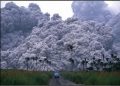
Since finishing up my extraordinary summer season as a park ranger at Yellowstone I find I have a lot of free time bouncing around in my head. I also realize that here in southern Utah I am surrounded by truly amazing geology and nearly endless hiking opportunities. I love the desert! Still, there is that irresistible tendency to enjoy a daydream or two of past travels and future adventure possibilities…For some reason I have always been drawn to the Canadian Rockies, like a rose waiting to be plucked and worn in my hair. I do not pretend to know much about the geology of the Canadian Rockies, but that in no way diminishes the fascination these rocks hold for me. I have been there twice in the past six years, to Yoho, Jasper, and Banff National Parks, and it isn’t nearly enough to satisfy me. I’ve got to get back to these awesome rocks. With mountains like this, can you blame me?
 |
| Isoclinal folding photographed in the rain |
 |
The above two photos were taken on my last trip in 2008 when I was travelling with two acutely geology–crazed friends. I had hiked trails in Banff and a glacier in Jasper, and been a volunteer assistant guide on a hike to the Walcott Quarry in Yoho with the Burgess Shale Geoscience Foundation. We were on our way home to Utah, heading south from Canmore, Alberta on densely forested Highway 40 through Peter Lougheed Provincial Park in Kananaskis Country. It was a gray, drizzly early morning as my car’s windshield wipers knocked a squeaky beat with the monotonous drone of tires rolling on asphalt. My friends were just ahead on the wet, winding road. Somewhere we paused for a moment to watch a small grizzly ignore us as it fed by the side of the highway, but sadly it appeared there would be little other opportunity for any final sightseeing on this part of the trip. It was just too foggy.
But then through the misty towering evergreens this jagged mountain thrust itself into view, totally taking my breath away. I nearly drove off the pavement and into the trees; I was absolutely awestruck by the sight of these seriously uplifted, tightly folded rock layers. It had to be among the most captivating scenes I had ever witnessed. I slammed on my brakes to pull over to the shoulder while my friends sailed onward, disappearing around a bend in the highway.
What circumstances in the Earth’s crust resulted in these rock layers shooting skyward like this? Over the few intervening years since those amazing journeys, the thoughts and ideas that I had assembled about Canadian geology have become a bit fuzzy. Nevertheless, as the person guilty of starting this thread I will gladly drag out my images and maps and reference books, along with a journal I kept, and try to (once again) wrestle some sense out of it all. And so, over the next who–knows–how–long, we will peer back into the past six years (or will it be at least 500 million years?) and continue our sojourn into the spectacular Canadian Rockies.This day is definitely a keeper.
 |
| Trail to Scout Cave |
Great weather is not hard to come by in southern Utah, especially in the autumn months. The first day of November, however, is exceptional. Just ahead of the onset of a predicted cold front (with possible winds up to 60 mph) our early morning skies are cloudless crystal blue clear with a breeze that could scarcely ruffle a raven feather. Afternoon temperatures lightly kiss the low 70’s.
My Tuesday–hiking–buddy Judy chooses to lead us to Scout Cave and so I find myself once again in the Red Cliffs Desert Reserve of red–rock sandstone hoodoos and precipitous cliffs. Even after living in southern Utah for 16 years I had never been to this particular spot. I happily put my life (or at least my mid-morning) into her carefree map–free hands.
 |
| I was dragged up here to see this? |
Along the trail we gaze down on the dark Santa Clara basalt flow cascading from vents above nearby Snow Canyon (check out my post about this flow here).
 |
| Black Santa Clara flow contrasts red sandstones |
The trail contours around and down into an elongated canyon of fractured sandstone cliffs.
 |
| Trail contours down to the right |
Scout Cave can be found eroded into one of these fractures.
 |
| Scout Cave |
 |
| Judy snacking – Scout Cave for scale |
The fracture that forms the cave goes all the way up through the sandstone.
 |
| Catching daylight |
Flat rocks inside the coolness of the cave beckon us to park ourselves and enjoy a snack. The expansive view beyond the towns of Ivins and Santa Clara towards the Beaver Dam Mountains captures our attention as we chew and chat. We explore outside a second nearby cave involving a short but tricky ascent with dubious handholds. We freely admit to our sketchy rock–climbing abilities and so leave that cave scouting for perhaps another day.
 |
| From the inside |