The stars had disappeared with the morning light but the roar of traffic remained. We drank our cowboy coffee, ate our instant oatmeal, packed up our gear, and wedged ourselves cozily into our three rented vehicles for the second day of the Southern Utah University Geology Symposium field trip. We left the trailer at the campground where we would retrieve it on our way home.
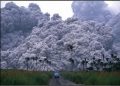
![]() |
Virgin River Gorge, AZ |
![]() |
Cedar Pockets campground |
![]() |
Aztec Sandstone at Whitney Pocket |
The geology of the southern Nevada/Lake Mead area is complicated by exposed Mesozoic thrust faults, exhumed tilted fault blocks of Precambrian crystalline basement rocks, extensive Tertiary volcanism, strike-slip faults of the right-lateral Las Vegas Valley shear zone, and the left-lateral Lake Mead fault system.
![]() |
Image courtesy of Geologic Tours in the Las Vegas Area |
Sedimentary rocks of the Horse Spring Formation were a result of crustal extension in southern Nevada between ≈17-10 million years ago. The rocks most likely were deposited in large basins that contained periodic lakes during a time of less arid desert conditions. There is much tectonic history with these rocks, notably regarding movement of Frenchman’s Mountain, presently near Las Vegas, 50 miles along a fault-guided path.
However, what we were looking for on this day was evidence to support a theory that the Colorado River had flowed north along a course into Canada ≈20 million years ago. The basal Horse Spring Formation would be the conglomerates of the ancient Colorado River channel (click here for James Sears' abstract from symposium).

We searched for gravels at a lunch spot, but it turned out we were on the wrong side of the ridge. Note spare tire on the vehicle on the right.
After lunch we checked the map and were soon bouncing back down the graded road. A turn here and a turn there, and we eventually found what we were looking for – the basal member of the Horse Spring Formation.
![]() |
Outcrops of Horse Spring Formation |


Interestingly, these imbricated gravels, arranged like shingles on a roof, show that the direction of river flow was to the left. It totally blows me away when I see these structures in the field – they become so much more real and comprehensible and are not just pictures in a textbook.
![]() |
imbricated gravel showing flow of water to the left |
![]() |
travertine |
We chatted about why these various–sized white travertine clasts were deposited here and where they had come from. Travertine is a sedimentary carbonate rock composed of calcite or aragonite with some impurities. It derives from the evaporation of calcium carbonate–rich spring waters near waterfalls and in rivers (the Colorado River of 20 million years ago, perhaps?) and now commonly occurs in the Great Basin of Nevada.
Daylight burned as we were absorbed in the Horse Spring Formation but ultimately we had to leave. Somewhere along this scenic piece of real estate our second (or was it our third?) flat tire hit us. With such a lovely angular unconformity in the distance, though, it was difficult to stress over anything – except what we would do if we had another flat.
![]() |
angular unconformity |
Our last but not least stop was at an outcrop of sheared metamorphic rock. We found some samples of what looked like an eclogite and tossed them in the vehicle to take back to the thin section lab. We then had our fourth flat tire crossing the alluvium into Mesquite. By now the sun was inching itself down to kiss the horizon.
We were totally tired of tires and entirely out of spares.
![]() |
Virgin Mountains |
Cell phones whipped out faster than a roadrunner on speed. It took a while to arrive at a consensus of sorts. In the end, though, the consensus took on a life of its own as soon as the first vehicle drove away to somewhere acquire a tire and have it transported back to the spareless remaining vehicles. We did not really have all our rocks in a row but we seemed to be making incremental progress towards home.
Then the vehicle in charge of tire procurement had the fifth flat, 11 miles north of Mesquite. All we could do at that point was call AAA. We sat on the side of Interstate 15 for an hour and a half, in the dark, as traffic whizzed by. We never did see the other two vehicles.
There is much more to the story but I have exhausted myself relating this part of it.
Our vehicle was towed 100 miles and I would not be surprised if the other two had been left abandoned by the side of the road. Someone picked up the trailer at Cedar Pockets campground. I got home at midnight and the Cedar City/SUU contingent got home around 3:30 Sunday morning.
I definitely want to know who is in charge of field trips next year.
![]() |
Desert marigold |
References:
Tingley, J.V. et al., 2001, Geologic Tours in the Las Vegas Area Expanded Edition, Nevada Bureau of Mines and Geology, Special Publication 16
http://geopubs.wr.usgs.gov/open-file/of99-435/ (accessed 4-6-2011)
What an adventure/nightmare to admire some great rocks. I'm not signing up for next year until you find out who's in charge. ;)
ReplyDeleteYet again, a wonderful explanation of the geology. Have you read anything about the recent theories that the Colorado River, and canyon, is Much older than the long supported 5-6 million years.?
Yes - the second day of the field trip was all about looking at evidence for an ancestral Colorado River around 20 million years old. Amazing, really, to listen to the theory; it was quite plausible.
ReplyDelete